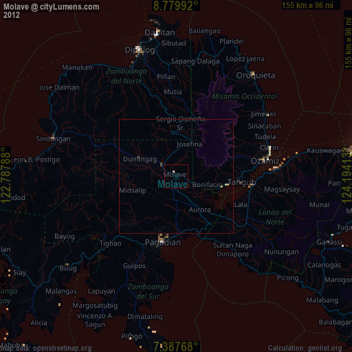
Molave night lights from space
Night Light of Molave (Zamboanga Peninsula) from space (Philippines) Src. Average luminocity for 10x10km area is 2.4855% and for 50x50km: 0.3444%.
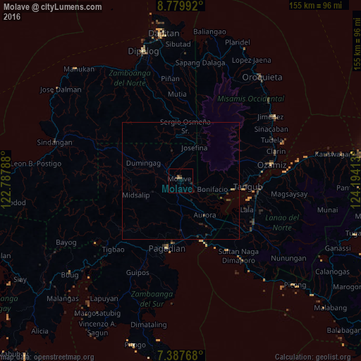
Analysis of Molave night lights 2016
Square area 10x10 km:
 0%
0%90-99
0%80-89
0%70-79
0%60-69
1.86%50-59
0.62%40-49
0%30-39
1.65%20-29
0.83%10-19
0%0-9
95.04%Square area 50x50 km:
0%90-99
0%80-89
0%70-79
0.07%60-69
0.08%50-59
0.03%40-49
0.09%30-39
0.19%20-29
0.19%10-19
0.12%0-9
99.23%Clear (daylight) street map image can be seen on geolist.org.
Map coordinates:
8° 46' 47.7" North, 122° 47' 16.4" East
8° 5' 3.8" North, 123° 29' 27.6" East
7° 23' 15.6" North, 124° 11' 38.9" East
Some cities around Molave sort by population:
• Muricay
28.6 km =17.8 mi,  182°
182°
• Tangub
28.4 km =17.6 mi,  95°
95°
• Mahayag
6.3 km =3.9 mi,  306°
306°
• Tucuran
27.4 km =17 mi,  160°
160°
• Labangan
24.5 km =15.2 mi,  174°
174°
• Aurora
18 km =11.2 mi,  145°
145°
• Tambulig
5.1 km =3.2 mi,  108°
108°
• Dumingag
18.1 km =11.2 mi,  301°
301°
1699388 (p: 21,088)
Sources (retrieved 2019-11-25):
» Earth at Night: Flat Maps 2012, 2016