Langcangan night lights from space
Night Light of Langcangan (Northern Mindanao) from space (Philippines) Src. Average luminocity for 10x10km area is 1.4649% and for 50x50km: 0.2894%.
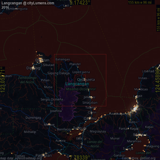
Analysis of Langcangan night lights 2016
Square area 10x10 km:
 0%
0%90-99
0%80-89
0%70-79
0%60-69
0%50-59
0%40-49
1.03%30-39
1.65%20-29
0.83%10-19
0.62%0-9
95.87%Square area 50x50 km:
0%90-99
0%80-89
0.03%70-79
0%60-69
0.04%50-59
0.06%40-49
0.09%30-39
0.22%20-29
0.11%10-19
0.08%0-9
99.36%Clear (daylight) street map image can be seen on geolist.org.
Map coordinates:
9° 10' 27.2" North, 123° 3' 9.8" East
8° 28' 46" North, 123° 45' 21" East
7° 47' 0.2" North, 124° 27' 32.3" East
Some cities around Langcangan sort by population:
• Ozamiz City
38 km =23.6 mi,  165°
165°
• Dapitan
41.6 km =25.8 mi,  298°
298°
• Oroquieta
5.4 km =3.4 mi,  82°
82°
• Maigo
41.8 km =26 mi,  147°
147°
• Clarin
32.8 km =20.4 mi,  159°
159°
• Calamba
15.3 km =9.5 mi,  305°
305°
• Jimenez
18.3 km =11.4 mi, 150°
• Bacolod
44 km =27.3 mi, 156°
1707574 (p: 8,707)
Sources (retrieved 2019-11-25):
» Earth at Night: Flat Maps 2012, 2016