Dinahican night lights from space
Night Light of Dinahican (Calabarzon) from space (Philippines) Src. Average luminocity for 10x10km area is 0% and for 50x50km: 0.0812%.
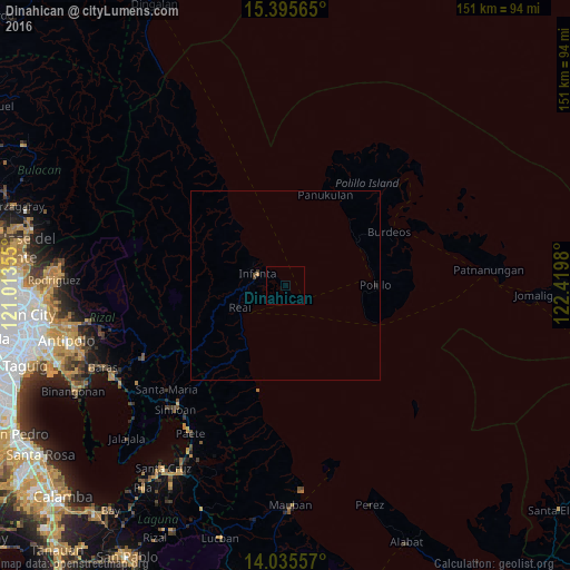
Analysis of Dinahican night lights 2016
Square area 10x10 km:
 0%
0%90-99
0%80-89
0%70-79
0%60-69
0%50-59
0%40-49
0%30-39
0%20-29
0%10-19
0%0-9
100%Square area 50x50 km:
0%90-99
0%80-89
0%70-79
0.03%60-69
0%50-59
0%40-49
0.07%30-39
0.03%20-29
0.03%10-19
0%0-9
99.83%Clear (daylight) street map image can be seen on geolist.org.
Map coordinates:
15° 23' 44.3" North, 121° 0' 48.8" East
14° 43' 0" North, 121° 43' 0" East
14° 2' 8.1" North, 122° 25' 11.3" East
Some cities around Dinahican sort by population:
• Sampaloc
43.1 km =26.8 mi,  242°
242°
• Pangil
44.1 km =27.4 mi,  217°
217°
• Real
13.4 km =8.3 mi, 244°
• Kalayaan
43.9 km =27.3 mi,  201°
201°
• Santa Maria
41.2 km =25.6 mi,  228°
228°
• Polillo
25 km =15.5 mi,  89°
89°
• Bantilan
6.9 km =4.3 mi,  311°
311°
• Infanta
7.9 km =4.9 mi,  293°
293°
1714784 (p: 7,062)
Sources (retrieved 2019-11-25):
» Earth at Night: Flat Maps 2012, 2016