Cuyapo night lights from space
Night Light of Cuyapo (Central Luzon) from space (Philippines) Src. Average luminocity for 10x10km area is 1.4567% and for 50x50km: 2.8208%.
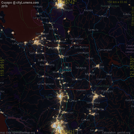
Analysis of Cuyapo night lights 2016
Square area 10x10 km:
 0%
0%90-99
0%80-89
0%70-79
0%60-69
0.87%50-59
0%40-49
0%30-39
1.3%20-29
0.43%10-19
0%0-9
97.4%Square area 50x50 km:
0.02%90-99
0.05%80-89
0.29%70-79
0.61%60-69
0.48%50-59
0.22%40-49
0.87%30-39
1.02%20-29
0.57%10-19
0.74%0-9
95.13%Clear (daylight) street map image can be seen on geolist.org.
Map coordinates:
16° 27' 26.7" North, 119° 57' 41.8" East
15° 46' 55" North, 120° 39' 53" East
15° 6' 15.2" North, 121° 22' 4.3" East
Some cities around Cuyapo sort by population:
• Paniqui
15.5 km =9.6 mi,  215°
215°
• Burgos
11.5 km =7.1 mi,  239°
239°
• Ramos
13.2 km =8.2 mi,  191°
191°
• Rosales
13 km =8.1 mi,  344°
344°
• Carmen
13.5 km =8.4 mi,  329°
329°
• Puelay
15.2 km =9.4 mi,  320°
320°
• Nampicuan
7 km =4.3 mi, 217°
• Baquero Norte
13.9 km =8.6 mi, 238°
1716401 (p: 8,595)
Sources (retrieved 2019-11-25):
» Earth at Night: Flat Maps 2012, 2016