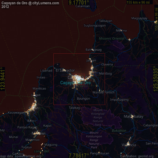
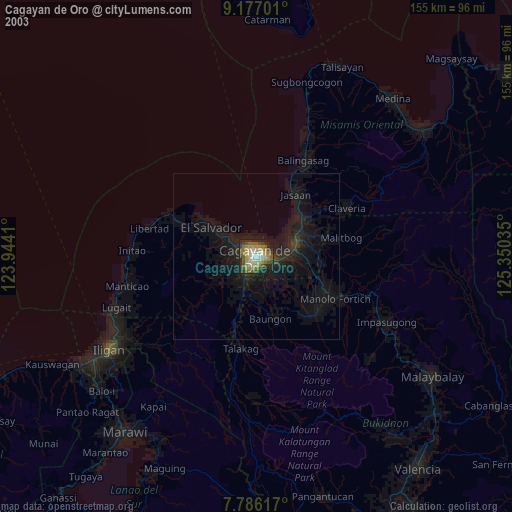
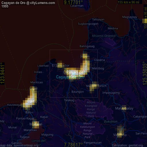
Cagayan de Oro night lights from space
Night Light of Cagayan de Oro (Northern Mindanao) from space (Philippines) Src. Average luminocity for 10x10km area is 59.1653% and for 50x50km: 6.2114%.
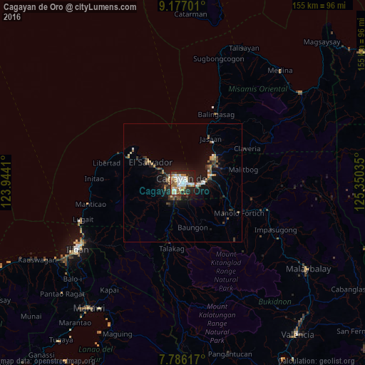
Analysis of Cagayan de Oro night lights 2016
Square area 10x10 km:
 14.88%
90-99
13.84%80-89
7.02%70-79
8.26%60-69
7.02%50-59
6.82%40-49
5.79%30-39
2.27%20-29
21.28%10-19
12.81%0-9
0%Square area 50x50 km:
0.77%90-99
0.97%80-89
0.56%70-79
0.68%60-69
0.78%50-59
0.93%40-49
0.82%30-39
0.99%20-29
1.7%10-19
5.11%0-9
86.68%Clear (daylight) street map image can be seen on geolist.org.
Map coordinates:
9° 10' 37.2" North, 123° 56' 38.8" East
8° 28' 56" North, 124° 38' 50" East
7° 47' 10.2" North, 125° 21' 1.3" East
Some cities around Cagayan de Oro sort by population:
• Bugo
12.7 km =7.9 mi,  76°
76°
• Tagoloan
13.4 km =8.3 mi,  61°
61°
• Agusan
9.9 km =6.2 mi, 84°
• Barra
5.6 km =3.5 mi,  303°
303°
• Molugan
11.2 km =7 mi, 303°
• Lumbia
11.3 km =7 mi,  211°
211°
• Santa Ana
15.5 km =9.6 mi, 75°
• Igpit
7.4 km =4.6 mi, 295°
1721080 (p: 445,103)
Sources (retrieved 2019-11-25):
» NASA, Earths city lights 1995
» NASA city lights 2003
» Earth at Night: Flat Maps 2012, 2016