Baybay night lights from space
Night Light of Baybay (Eastern Visayas) from space (Philippines) Src. Average luminocity for 10x10km area is 2.2583% and for 50x50km: 0.1959%.
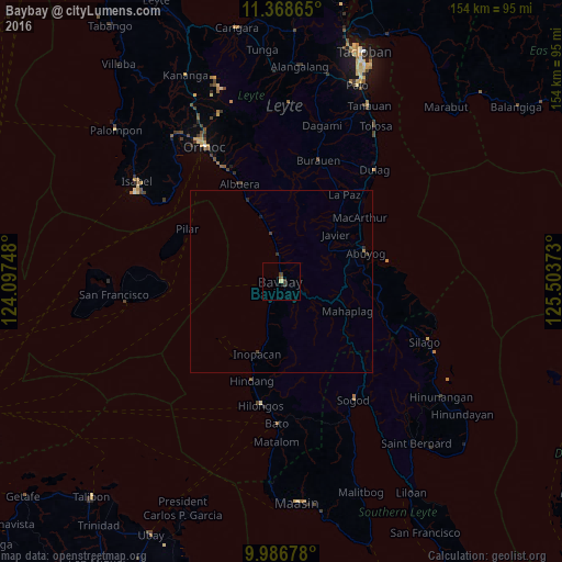
Analysis of Baybay night lights 2016
Square area 10x10 km:
 0%
0%90-99
0%80-89
0.83%70-79
0%60-69
0%50-59
0.62%40-49
0.83%30-39
1.86%20-29
0%10-19
0%0-9
95.87%Square area 50x50 km:
0%90-99
0%80-89
0.03%70-79
0%60-69
0.03%50-59
0.03%40-49
0.09%30-39
0.16%20-29
0.06%10-19
0.03%0-9
99.56%Clear (daylight) street map image can be seen on geolist.org.
Map coordinates:
11° 22' 7.1" North, 124° 5' 50.9" East
10° 40' 42.6" North, 124° 48' 2.2" East
9° 59' 12.4" North, 125° 30' 13.4" East
Some cities around Baybay sort by population:
• Ormoc
42.1 km =26.2 mi,  329°
329°
• Abuyog
24.2 km =15 mi,  71°
71°
• Burauen
34.5 km =21.4 mi,  16°
16°
• Dulag
39.6 km =24.6 mi,  39°
39°
• Bato
39 km =24.2 mi,  181°
181°
• Sogod
38.2 km =23.7 mi,  148°
148°
• Hilongos
34.3 km =21.3 mi,  189°
189°
• Balogo
25.2 km =15.7 mi,  336°
336°
1725799 (p: 17,668)
Sources (retrieved 2019-11-25):
» Earth at Night: Flat Maps 2012, 2016