Bayambang night lights from space
Night Light of Bayambang (Ilocos) from space (Philippines) Src. Average luminocity for 10x10km area is 5.987% and for 50x50km: 4.4642%.
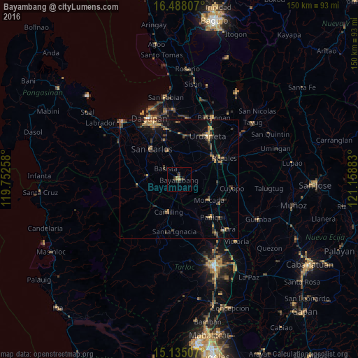
Analysis of Bayambang night lights 2016
Square area 10x10 km:
 0%
0%90-99
0%80-89
0.87%70-79
0.87%60-69
1.73%50-59
0.22%40-49
3.68%30-39
1.3%20-29
1.52%10-19
1.08%0-9
88.74%Square area 50x50 km:
0.03%90-99
0.07%80-89
0.38%70-79
1.01%60-69
0.99%50-59
0.48%40-49
1.11%30-39
1.35%20-29
1.06%10-19
2%0-9
91.51%Clear (daylight) street map image can be seen on geolist.org.
Map coordinates:
16° 29' 17.1" North, 119° 45' 9.3" East
15° 48' 45.7" North, 120° 27' 20.5" East
15° 8' 6.3" North, 121° 9' 31.8" East
Some cities around Bayambang sort by population:
• Urbiztondo
13.5 km =8.4 mi,  274°
274°
• Sapang
14.2 km =8.8 mi,  148°
148°
• Alcala
8.3 km =5.2 mi,  62°
62°
• Lepa
8 km =5 mi,  356°
356°
• Loqueb Este
14.7 km =9.1 mi, 355°
• Dumpay
10.6 km =6.6 mi,  317°
317°
• Dorongan Punta
14.2 km =8.8 mi, 270°
• Sinilian First
13.3 km =8.3 mi,  178°
178°
1725863 (p: 15,859)
Sources (retrieved 2019-11-25):
» Earth at Night: Flat Maps 2012, 2016