Baracatan night lights from space
Night Light of Baracatan (Davao) from space (Philippines) Src. Average luminocity for 10x10km area is 1.8853% and for 50x50km: 10.4592%.
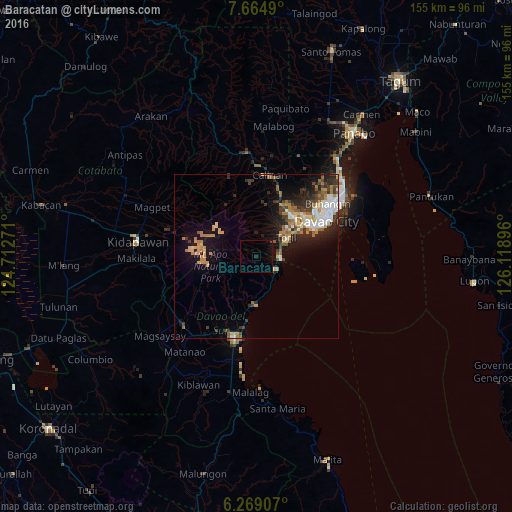
Analysis of Baracatan night lights 2016
Square area 10x10 km:
100  0%
0%
90-99 0%
80-89 0%
70-79 0%
60-69 0%
50-59 0%
40-49 0.87%
30-39 0%
20-29 0.87%
10-19 0.87%
0-9 97.4%
0%90-99
0%80-89
0%70-79
0%60-69
0%50-59
0%40-49
0.87%30-39
0%20-29
0.87%10-19
0.87%0-9
97.4%Square area 50x50 km:
100 1.61%
90-99 1.29%
80-89 0.93%
70-79 1.75%
60-69 1.91%
50-59 1.42%
40-49 1.11%
30-39 1.85%
20-29 2.92%
10-19 5.88%
0-9 79.34%
1.61%90-99
1.29%80-89
0.93%70-79
1.75%60-69
1.91%50-59
1.42%40-49
1.11%30-39
1.85%20-29
2.92%10-19
5.88%0-9
79.34%Clear (daylight) street map image can be seen on geolist.org.
Map coordinates:
7° 39' 53.6" North, 124° 42' 45.8" East
6° 58' 3" North, 125° 24' 57" East
6° 16' 8.7" North, 126° 7' 8.3" East
Some cities around Baracatan sort by population:
• Astorga
8 km =5 mi,  146°
146°
• Sibulan
6.4 km =4 mi,  126°
126°
• Coronon
10.5 km =6.5 mi,  159°
159°
• Tamayong
18.8 km =11.7 mi,  347°
347°
• Inawayan
6.4 km =4 mi,  96°
96°
• Tuban
16.4 km =10.2 mi,  191°
191°
• Sirib
18.5 km =11.5 mi,  357°
357°
• Bato
10.5 km =6.5 mi,  36°
36°
1726844 (p: 7,298)
Sources (retrieved 2019-11-25):
» Earth at Night: Flat Maps 2012, 2016