Faaa night lights from space
Night Light of Faaa (Îles du Vent) from space (French Polynesia) Src. Average luminocity for 10x10km area is 34.0723% and for 50x50km: 3.0846%.
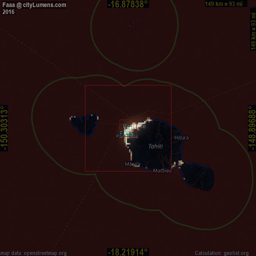
Analysis of Faaa night lights 2016
Square area 10x10 km:
100  3.72%
3.72%
90-99 9.92%
80-89 6.82%
70-79 1.65%
60-69 4.34%
50-59 1.65%
40-49 2.89%
30-39 2.07%
20-29 5.79%
10-19 41.74%
0-9 19.42%
3.72%90-99
9.92%80-89
6.82%70-79
1.65%60-69
4.34%50-59
1.65%40-49
2.89%30-39
2.07%20-29
5.79%10-19
41.74%0-9
19.42%Square area 50x50 km:
100 0.19%
90-99 0.66%
80-89 0.54%
70-79 0.22%
60-69 0.29%
50-59 0.28%
40-49 0.65%
30-39 0.2%
20-29 0.39%
10-19 3.38%
0-9 93.2%
0.19%90-99
0.66%80-89
0.54%70-79
0.22%60-69
0.29%50-59
0.28%40-49
0.65%30-39
0.2%20-29
0.39%10-19
3.38%0-9
93.2%Clear (daylight) street map image can be seen on geolist.org.
Map coordinates:
16° 52' 42.2" South, 150° 18' 11.3" West
17° 33' 0" South, 149° 36' 0" West
18° 13' 8.9" South, 148° 53' 48.8" West
Some cities around Faaa sort by population:
• Papeete
3.8 km =2.4 mi,  68°
68°
• Punaauia
9.3 km =5.8 mi,  180°
180°
• Pirae
8 km =5 mi,  62°
62°
• Mahina
12.7 km =7.9 mi, 67°
• Paea
14.9 km =9.3 mi,  173°
173°
• Papao
22.9 km =14.2 mi, 166°
• Arue
11.2 km =7 mi, 70°
• Afaahiti
36.3 km =22.6 mi,  126°
126°
4034561 (p: 29,851)
Sources (retrieved 2019-11-25):
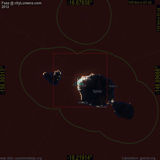
» Earth at Night: Flat Maps 2012, 2016