Chosica night lights from space
Night Light of Chosica (Lima region) from space (Peru) Src. Average luminocity for 10x10km area is 38.9215% and for 50x50km: 15.5351%.
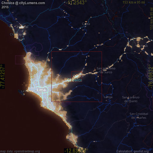
Analysis of Chosica night lights 2016
Square area 10x10 km:
 2.89%
2.89%90-99
6.61%80-89
3.1%70-79
5.37%60-69
13.84%50-59
4.34%40-49
5.17%30-39
3.31%20-29
6.82%10-19
39.67%0-9
8.88%Square area 50x50 km:
1.45%90-99
1.73%80-89
1.12%70-79
2.62%60-69
6%50-59
2.42%40-49
2.63%30-39
2.34%20-29
2.86%10-19
6.62%0-9
70.21%Clear (daylight) street map image can be seen on geolist.org.
Map coordinates:
11° 15' 15.5" South, 77° 24' 45.3" West
11° 56' 35" South, 76° 42' 34" West
12° 37' 48.3" South, 76° 0' 22.8" West
Some cities around Chosica sort by population:
• Lima
36.4 km =22.6 mi,  252°
252°
• Callao
46.2 km =28.7 mi, 254°
• Santiago de Surco
38.9 km =24.2 mi,  236°
236°
• San Isidro
41.8 km =26 mi, 242°
• Santa María
21.2 km =13.2 mi, 250°
• San Luis
34.4 km =21.4 mi, 244°
• Asentamiento Humano Nicolas de Pierola
0.9 km =0.6 mi,  23°
23°
• San Bartolo
49.6 km =30.8 mi,  189°
189°
3943423 (p: 88,606)
Sources (retrieved 2019-11-25):
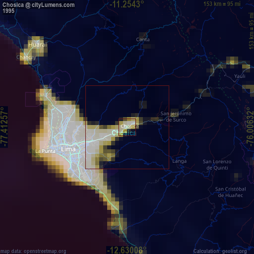
» NASA, Earths city lights 1995
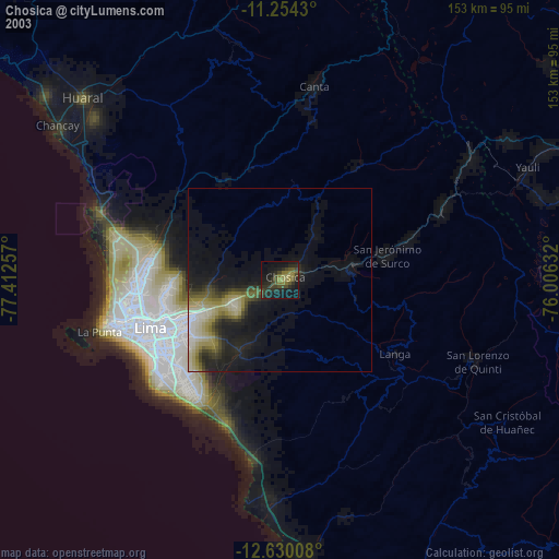
» NASA city lights 2003
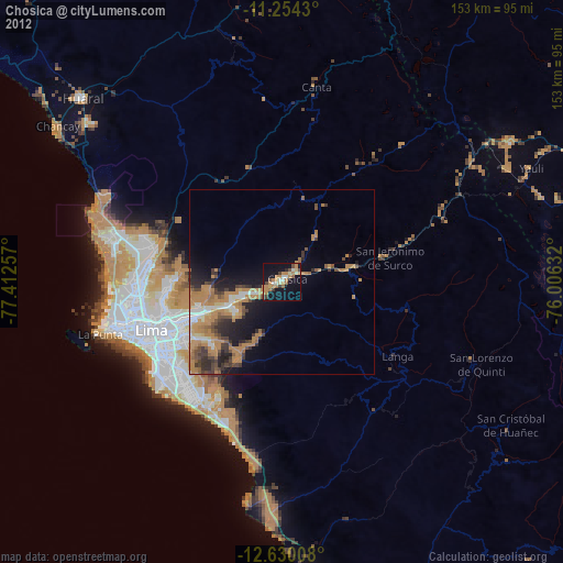
» Earth at Night: Flat Maps 2012, 2016