Callao night lights from space
Night Light of Callao from space (Peru) Src. Average luminocity for 10x10km area is 82.2107% and for 50x50km: 40.6039%.
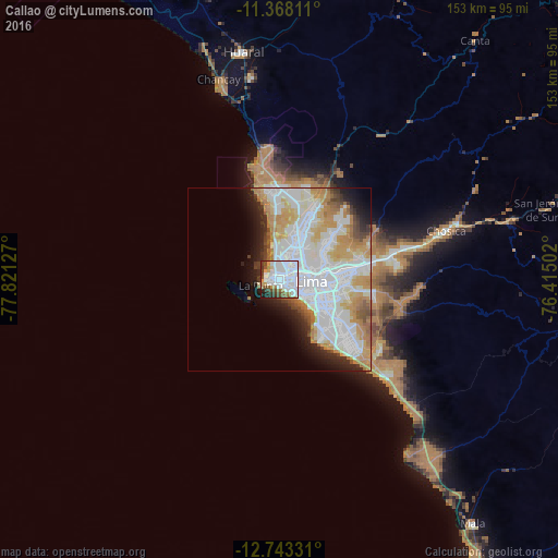
Analysis of Callao night lights 2016
Square area 10x10 km:
 50%
50%90-99
14.05%80-89
2.48%70-79
4.75%60-69
5.58%50-59
5.37%40-49
6.82%30-39
5.58%20-29
3.93%10-19
1.45%0-9
0%Square area 50x50 km:
15.77%90-99
9.55%80-89
3.91%70-79
6.04%60-69
4.7%50-59
1.99%40-49
1.9%30-39
2.06%20-29
3.72%10-19
5.46%0-9
44.88%Clear (daylight) street map image can be seen on geolist.org.
Map coordinates:
11° 22' 5.2" South, 77° 49' 16.6" West
12° 3' 23.7" South, 77° 7' 5.3" West
12° 44' 35.9" South, 76° 24' 54.1" West
Some cities around Callao sort by population:
• Lima
9.9 km =6.2 mi,  81°
81°
• Santiago de Surco
14.9 km =9.3 mi,  126°
126°
• Chosica
46.2 km =28.7 mi,  74°
74°
• San Isidro
10 km =6.2 mi, 132°
• Santa María
25.1 km =15.6 mi, 76°
• San Luis
13.6 km =8.5 mi,  99°
99°
• Asentamiento Humano Nicolas de Pierola
46.8 km =29.1 mi, 73°
• San Bartolo
51.4 km =31.9 mi, 134°
3946083 (p: 813,264)
Sources (retrieved 2019-11-25):
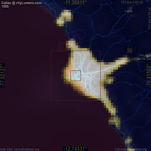
» NASA, Earths city lights 1995
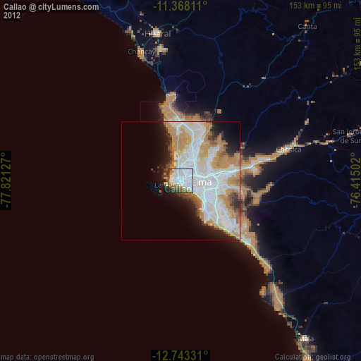
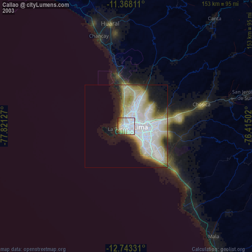
» NASA city lights 2003
» Earth at Night: Flat Maps 2012, 2016