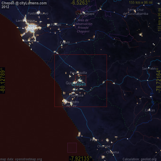
Chepén night lights from space
Night Light of Chepén (La Libertad) from space (Peru) Src. Average luminocity for 10x10km area is 28.868% and for 50x50km: 4.9566%.
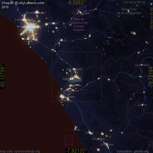
Analysis of Chepén night lights 2016
Square area 10x10 km:
 0%
0%90-99
8.44%80-89
3.46%70-79
4.33%60-69
5.84%50-59
0.65%40-49
4.33%30-39
2.38%20-29
3.46%10-19
41.56%0-9
25.54%Square area 50x50 km:
0.18%90-99
1%80-89
0.54%70-79
0.63%60-69
0.63%50-59
0.45%40-49
0.85%30-39
0.71%20-29
0.56%10-19
5.91%0-9
88.54%Clear (daylight) street map image can be seen on geolist.org.
Map coordinates:
6° 31' 34.7" South, 80° 7' 40.4" West
7° 13' 27.7" South, 79° 25' 29.1" West
7° 55' 16.9" South, 78° 43' 17.9" West
Some cities around Chepén sort by population:
• Saña
38.1 km =23.7 mi,  332°
332°
• Pacasmayo
25.4 km =15.8 mi,  219°
219°
• Guadalupe
7.1 km =4.4 mi,  246°
246°
• Paiján
58.2 km =36.2 mi,  166°
166°
• San Pedro de Lloc
24.4 km =15.2 mi,  201°
201°
• Pacanga
10.5 km =6.5 mi,  307°
307°
• Oyotún
44.4 km =27.6 mi,  17°
17°
• Pueblo Nuevo
10.8 km =6.7 mi,  292°
292°
3698390 (p: 41,992)
Sources (retrieved 2019-11-25):
» Earth at Night: Flat Maps 2012, 2016