Vista Alegre night lights from space
Night Light of Vista Alegre (Panamá Oeste) from space (Panama) Src. Average luminocity for 10x10km area is 61.7662% and for 50x50km: 20.3695%.
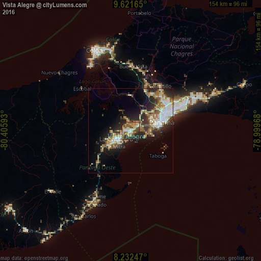
Analysis of Vista Alegre night lights 2016
Square area 10x10 km:
 8.44%
8.44%90-99
7.58%80-89
14.94%70-79
10.82%60-69
13.2%50-59
11.69%40-49
9.96%30-39
5.84%20-29
15.8%10-19
1.73%0-9
0%Square area 50x50 km:
3.44%90-99
3.51%80-89
2.75%70-79
2.36%60-69
2.82%50-59
3.59%40-49
2.38%30-39
3.39%20-29
6.33%10-19
8.51%0-9
60.91%Clear (daylight) street map image can be seen on geolist.org.
Map coordinates:
9° 37' 17.9" North, 80° 24' 21.3" West
8° 55' 39.8" North, 79° 42' 10.1" West
8° 13' 56.9" North, 78° 59' 58.8" West
Some cities around Vista Alegre sort by population:
• Arraiján
5.4 km =3.4 mi,  60°
60°
• La Chorrera
10.3 km =6.4 mi,  239°
239°
• Veracruz
9.4 km =5.8 mi,  116°
116°
• Nuevo Arraiján
1.9 km =1.2 mi,  259°
259°
• El Coco
12.8 km =8 mi, 240°
• Altos de San Francisco
12.1 km =7.5 mi,  232°
232°
• La Herradura
14.2 km =8.8 mi, 231°
• La Mitra
13.3 km =8.3 mi,  223°
223°
3700038 (p: 8,673)
Sources (retrieved 2019-11-25):
» Earth at Night: Flat Maps 2012, 2016