La Chorrera night lights from space
Night Light of La Chorrera (Panamá Oeste) from space (Panama) Src. Average luminocity for 10x10km area is 67.0952% and for 50x50km: 12.9468%.
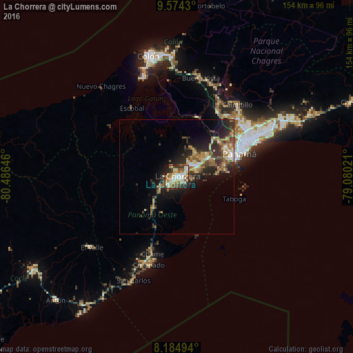
Analysis of La Chorrera night lights 2016
Square area 10x10 km:
 11.9%
11.9%90-99
18.18%80-89
10.39%70-79
12.55%60-69
7.36%50-59
9.74%40-49
8.44%30-39
8.44%20-29
8.66%10-19
4.33%0-9
0%Square area 50x50 km:
1.14%90-99
1.68%80-89
1.89%70-79
1.81%60-69
2.01%50-59
2.51%40-49
2.11%30-39
2.63%20-29
4.66%10-19
7.01%0-9
72.55%Clear (daylight) street map image can be seen on geolist.org.
Map coordinates:
9° 34' 27.5" North, 80° 29' 11.3" West
8° 52' 49" North, 79° 46' 60" West
8° 11' 5.8" North, 79° 4' 48.8" West
Some cities around La Chorrera sort by population:
• Nuevo Arraiján
8.5 km =5.3 mi,  54°
54°
• El Coco
2.6 km =1.6 mi,  243°
243°
• Vista Alegre
10.3 km =6.4 mi,  59°
59°
• Altos de San Francisco
2.2 km =1.4 mi,  199°
199°
• La Pesa
5.5 km =3.4 mi,  233°
233°
• Guadalupe
4.4 km =2.7 mi, 229°
• La Herradura
4.2 km =2.6 mi,  212°
212°
• La Mitra
4.4 km =2.7 mi,  184°
184°
3707961 (p: 61,232)
Sources (retrieved 2019-11-25):
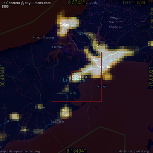
» NASA, Earths city lights 1995
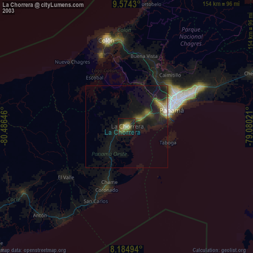
» NASA city lights 2003
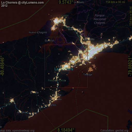
» Earth at Night: Flat Maps 2012, 2016