Arraiján night lights from space
Night Light of Arraiján (Panamá Oeste) from space (Panama) Src. Average luminocity for 10x10km area is 53.171% and for 50x50km: 22.9898%.
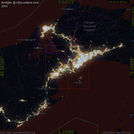
Analysis of Arraiján night lights 2016
Square area 10x10 km:
 3.25%
3.25%90-99
4.76%80-89
9.74%70-79
8.44%60-69
12.12%50-59
15.37%40-49
11.47%30-39
12.99%20-29
21.43%10-19
0.43%0-9
0%Square area 50x50 km:
4.05%90-99
4.06%80-89
2.98%70-79
2.62%60-69
3.25%50-59
3.9%40-49
2.62%30-39
3.88%20-29
7.16%10-19
9.75%0-9
55.73%Clear (daylight) street map image can be seen on geolist.org.
Map coordinates:
9° 38' 44.7" North, 80° 21' 47.7" West
8° 57' 6.7" North, 79° 39' 36.4" West
8° 15' 24" North, 78° 57' 25.2" West
Some cities around Arraiján sort by population:
• Panamá
16.1 km =10 mi,  73°
73°
• La Chorrera
15.7 km =9.8 mi,  239°
239°
• Ancón
12 km =7.5 mi,  85°
85°
• El Chorrillo
12.4 km =7.7 mi, 91°
• Veracruz
7.8 km =4.8 mi,  151°
151°
• Curundú
12.7 km =7.9 mi,  80°
80°
• Nuevo Arraiján
7.3 km =4.5 mi,  245°
245°
• Vista Alegre
5.4 km =3.4 mi, 240°
3714637 (p: 76,815)
Sources (retrieved 2019-11-25):
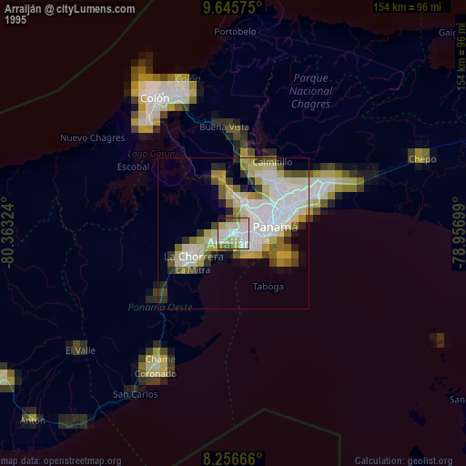
» NASA, Earths city lights 1995
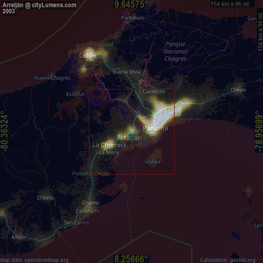
» NASA city lights 2003
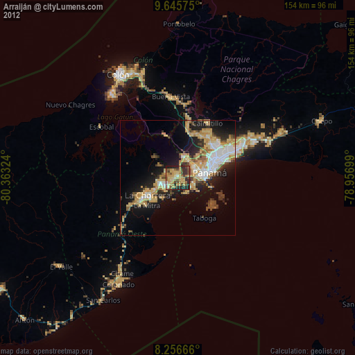
» Earth at Night: Flat Maps 2012, 2016