San Juan Bautista night lights from space
Night Light of San Juan Bautista (Herrera) from space (Panama) Src. Average luminocity for 10x10km area is 37.3884% and for 50x50km: 3.9027%.
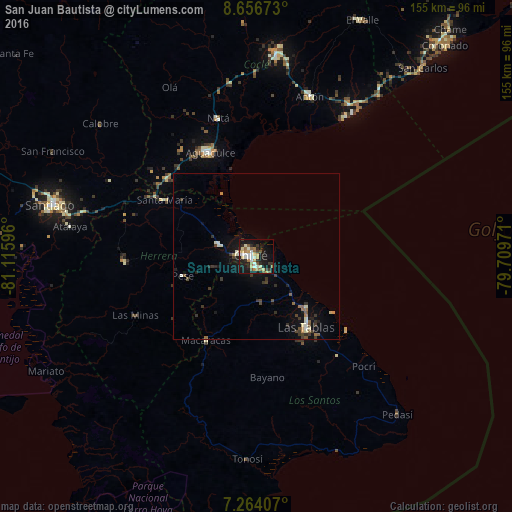
Analysis of San Juan Bautista night lights 2016
Square area 10x10 km:
 4.34%
4.34%90-99
8.26%80-89
5.79%70-79
5.37%60-69
4.13%50-59
6.61%40-49
1.03%30-39
5.79%20-29
6.61%10-19
36.57%0-9
15.5%Square area 50x50 km:
0.22%90-99
0.74%80-89
0.36%70-79
0.32%60-69
0.51%50-59
0.54%40-49
0.45%30-39
1.13%20-29
0.64%10-19
3.22%0-9
91.89%Clear (daylight) street map image can be seen on geolist.org.
Map coordinates:
8° 39' 24.2" North, 81° 6' 57.5" West
7° 57' 39.6" North, 80° 24' 46.2" West
7° 15' 50.7" North, 79° 42' 35" West
Some cities around San Juan Bautista sort by population:
• Pocrí
36.3 km =22.6 mi,  335°
335°
• Monagrillo
3.6 km =2.2 mi,  310°
310°
• Llano Bonito
1.8 km =1.1 mi,  346°
346°
• Chitré
1.8 km =1.1 mi,  269°
269°
• Las Tablas
26.6 km =16.5 mi,  145°
145°
• Aguadulce
34.5 km =21.4 mi,  334°
334°
• La Arena
5.8 km =3.6 mi,  277°
277°
• Los Santos
3.1 km =1.9 mi,  187°
187°
10179345 (p: 11,798)
Sources (retrieved 2019-11-25):
» Earth at Night: Flat Maps 2012, 2016