Las Tablas night lights from space
Night Light of Las Tablas (Los Santos) from space (Panama) Src. Average luminocity for 10x10km area is 21.312% and for 50x50km: 3.4175%.
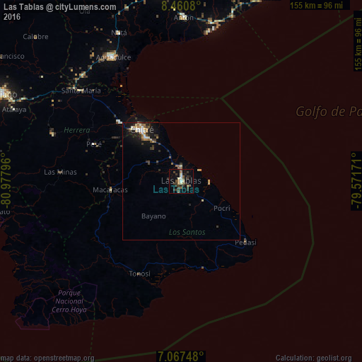
Analysis of Las Tablas night lights 2016
Square area 10x10 km:
 0.62%
0.62%90-99
3.51%80-89
1.65%70-79
0.83%60-69
2.48%50-59
4.55%40-49
4.13%30-39
11.78%20-29
2.27%10-19
14.26%0-9
53.93%Square area 50x50 km:
0.22%90-99
0.56%80-89
0.43%70-79
0.31%60-69
0.47%50-59
0.53%40-49
0.38%30-39
0.98%20-29
0.51%10-19
2.58%0-9
93.03%Clear (daylight) street map image can be seen on geolist.org.
Map coordinates:
8° 27' 38.9" North, 80° 58' 40.7" West
7° 45' 53" North, 80° 16' 29.4" West
7° 4' 2.9" North, 79° 34' 18.2" West
Some cities around Las Tablas sort by population:
• Pocrí
62.7 km =39 mi,  331°
331°
• San Juan Bautista
26.6 km =16.5 mi, 325°
• Monagrillo
30.1 km =18.7 mi,  323°
323°
• Llano Bonito
28.2 km =17.5 mi, 326°
• Chitré
27.7 km =17.2 mi, 322°
• Aguadulce
60.9 km =37.8 mi, 330°
• La Arena
30.8 km =19.1 mi, 317°
• Los Santos
24.4 km =15.2 mi, 320°
3706208 (p: 8,939)
Sources (retrieved 2019-11-25):
» Earth at Night: Flat Maps 2012, 2016