Fredrikstad night lights from space
Night Light of Fredrikstad (Østfold) from space (Norway) Src. Average luminocity for 10x10km area is 51.4603% and for 50x50km: 9.1266%.
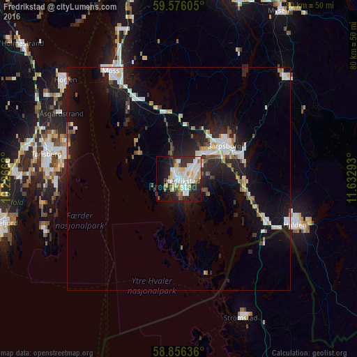
Analysis of Fredrikstad night lights 2016
Square area 10x10 km:
 13.38%
90-99
15.53%80-89
6.69%70-79
5.67%60-69
2.72%50-59
3.4%40-49
2.27%30-39
5.33%20-29
15.53%10-19
15.53%0-9
13.95%Square area 50x50 km:
1.63%90-99
2.09%80-89
0.8%70-79
0.74%60-69
0.73%50-59
0.8%40-49
0.73%30-39
0.71%20-29
3.23%10-19
8.05%0-9
80.51%Clear (daylight) street map image can be seen on geolist.org.
Map coordinates:
59° 34' 33.8" North, 10° 13' 36" East
59° 13' 5.2" North, 10° 55' 47.3" East
58° 51' 22.9" North, 11° 37' 58.5" East
Some cities around Fredrikstad sort by population:
• Sarpsborg
12.6 km =7.8 mi,  54°
54°
• Sandefjord
41.8 km =26 mi,  256°
256°
• Tønsberg
30.2 km =18.8 mi,  280°
280°
• Moss
28.5 km =17.7 mi,  327°
327°
• Halden
28.1 km =17.5 mi,  111°
111°
• Horten
33.6 km =20.9 mi,  311°
311°
• Askim
42.7 km =26.5 mi,  17°
17°
• Strömstad, SE
33.9 km =21.1 mi,  156°
156°
3156529 (p: 72,760)
Sources (retrieved 2019-11-25):
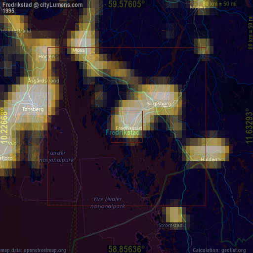
» NASA, Earths city lights 1995
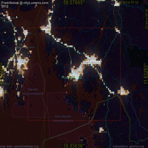
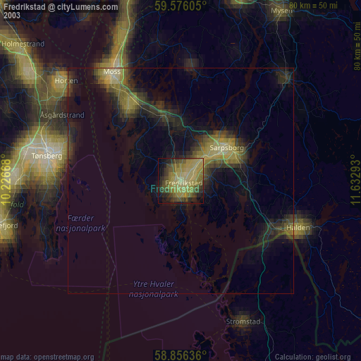
» NASA city lights 2003
» Earth at Night: Flat Maps 2012, 2016