Warnsveld night lights from space
Night Light of Warnsveld (Gelderland) from space (Netherlands) Src. Average luminocity for 10x10km area is 19.9418% and for 50x50km: 12.6524%.
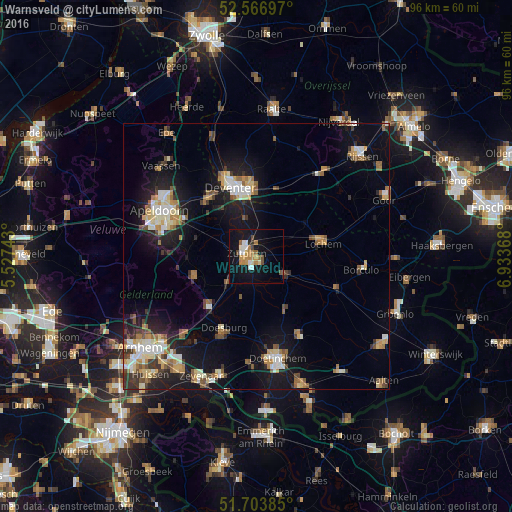
Analysis of Warnsveld night lights 2016
Square area 10x10 km:
 2.78%
2.78%90-99
2.65%80-89
1.32%70-79
3.84%60-69
4.1%50-59
1.59%40-49
2.91%30-39
0.53%20-29
1.32%10-19
23.41%0-9
55.56%Square area 50x50 km:
1.53%90-99
2.03%80-89
1.51%70-79
1.52%60-69
1.71%50-59
1.82%40-49
1.32%30-39
1.58%20-29
2.78%10-19
10.47%0-9
73.73%Clear (daylight) street map image can be seen on geolist.org.
Map coordinates:
52° 34' 1.1" North, 5° 31' 38.7" East
52° 8' 15" North, 6° 13' 50" East
51° 42' 13.9" North, 6° 56' 1.2" East
Some cities around Warnsveld sort by population:
• Deventer
13.8 km =8.6 mi,  340°
340°
• Zutphen
2 km =1.2 mi,  272°
272°
• Brummen
7.4 km =4.6 mi,  224°
224°
• Dieren
13 km =8.1 mi, 223°
• Twello
14.1 km =8.8 mi,  321°
321°
• Lochem
12.6 km =7.8 mi,  78°
78°
• Eerbeek
12.3 km =7.6 mi,  252°
252°
• Leesten
1.1 km =0.7 mi,  174°
174°
2745003 (p: 9,200)
Sources (retrieved 2019-11-25):
» Earth at Night: Flat Maps 2012, 2016