Leesten night lights from space
Night Light of Leesten (Gelderland) from space (Netherlands) Src. Average luminocity for 10x10km area is 19.6587% and for 50x50km: 12.7944%.
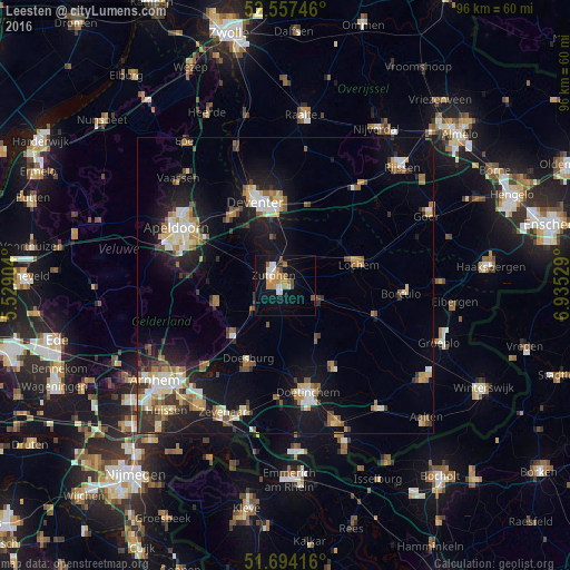
Analysis of Leesten night lights 2016
Square area 10x10 km:
 2.78%
2.78%90-99
2.65%80-89
1.32%70-79
3.84%60-69
4.1%50-59
1.59%40-49
3.04%30-39
0.53%20-29
1.32%10-19
19.58%0-9
59.26%Square area 50x50 km:
1.52%90-99
2.04%80-89
1.53%70-79
1.54%60-69
1.72%50-59
1.82%40-49
1.28%30-39
1.65%20-29
2.87%10-19
11.08%0-9
72.96%Clear (daylight) street map image can be seen on geolist.org.
Map coordinates:
52° 33' 26.9" North, 5° 31' 44.5" East
52° 7' 40.4" North, 6° 13' 55.8" East
51° 41' 39" North, 6° 56' 7" East
Some cities around Leesten sort by population:
• Deventer
14.9 km =9.3 mi,  341°
341°
• Zutphen
2.4 km =1.5 mi,  298°
298°
• Brummen
6.7 km =4.2 mi,  231°
231°
• Dieren
12.3 km =7.6 mi, 227°
• Lochem
12.7 km =7.9 mi,  74°
74°
• Doesburg
14.3 km =8.9 mi,  206°
206°
• Eerbeek
12.1 km =7.5 mi,  257°
257°
• Warnsveld
1.1 km =0.7 mi,  354°
354°
2751793 (p: 10,000)
Sources (retrieved 2019-11-25):
» Earth at Night: Flat Maps 2012, 2016