Oss night lights from space
Night Light of Oss (North Brabant) from space (Netherlands) Src. Average luminocity for 10x10km area is 36.9118% and for 50x50km: 23.3724%.
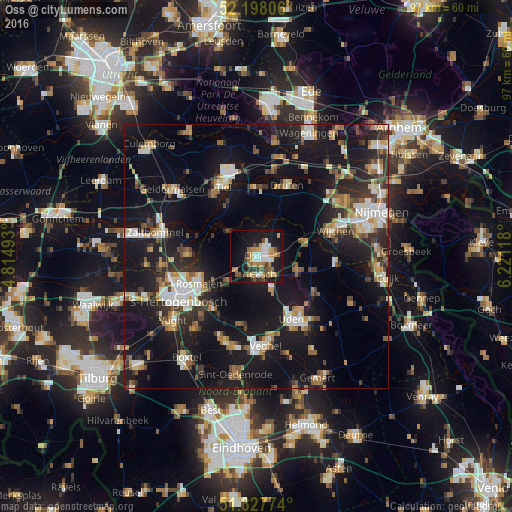
Analysis of Oss night lights 2016
Square area 10x10 km:
 6.3%
6.3%90-99
4.9%80-89
3.22%70-79
7.7%60-69
6.02%50-59
5.18%40-49
4.2%30-39
3.92%20-29
8.12%10-19
31.79%0-9
18.63%Square area 50x50 km:
2.96%90-99
3.75%80-89
2.07%70-79
2.6%60-69
3.21%50-59
2.81%40-49
2.62%30-39
3.46%20-29
6.65%10-19
27.32%0-9
42.54%Clear (daylight) street map image can be seen on geolist.org.
Map coordinates:
52° 11' 53" North, 4° 48' 53.7" East
51° 45' 54" North, 5° 31' 5" East
51° 19' 39.9" North, 6° 13' 16.2" East
Some cities around Oss sort by population:
• Tiel
14.8 km =9.2 mi,  335°
335°
• Uden
13.5 km =8.4 mi,  148°
148°
• Heesch
3.5 km =2.2 mi,  170°
170°
• Heeswijk-Dinther
13 km =8.1 mi,  193°
193°
• Kerkdriel
12.6 km =7.8 mi,  273°
273°
• Berghem
3.5 km =2.2 mi,  81°
81°
• Nistelrode
7.4 km =4.6 mi,  155°
155°
• Schaijk
8.1 km =5 mi,  105°
105°
2749234 (p: 76,430)
Sources (retrieved 2019-11-25):
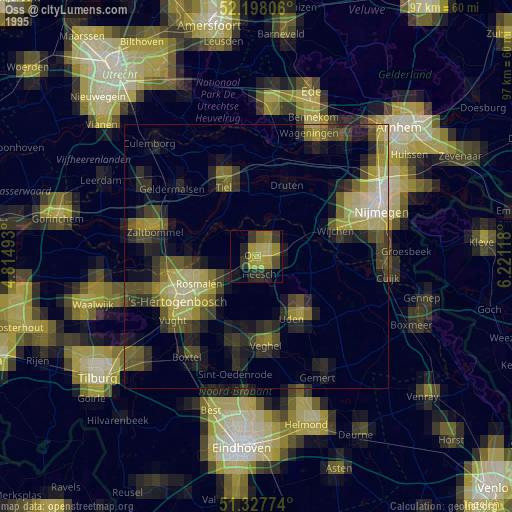
» NASA, Earths city lights 1995
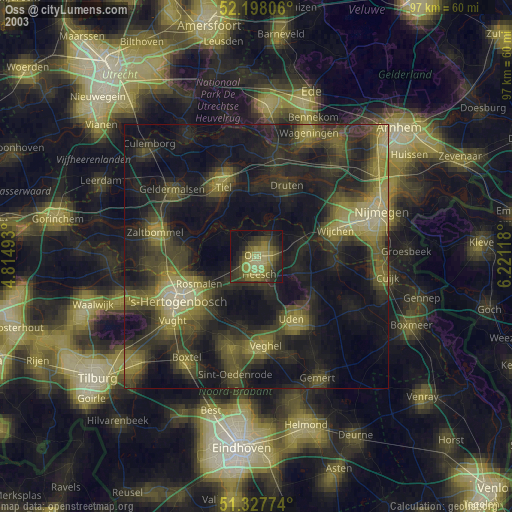
» NASA city lights 2003
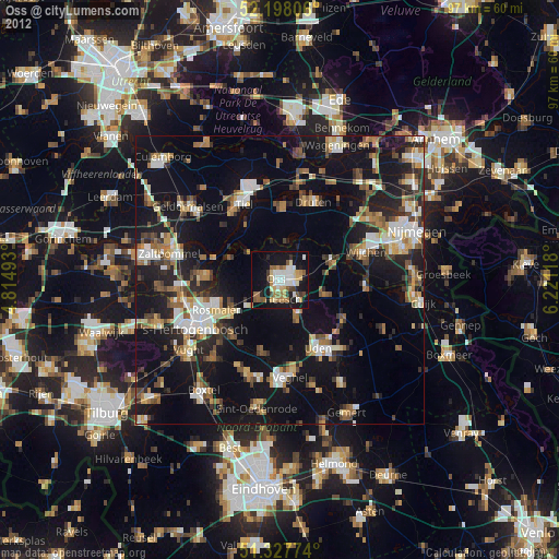
» Earth at Night: Flat Maps 2012, 2016