Ondo night lights from space
Night Light of Ondo from space (Nigeria) Src. Average luminocity for 10x10km area is 0.7165% and for 50x50km: 0.0289%.
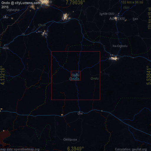
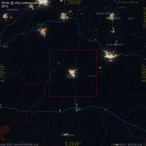
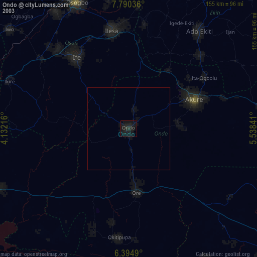
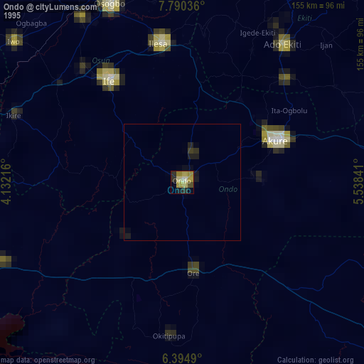
Analysis of Ondo night lights 2016
Square area 10x10 km:
 0%
0%90-99
0%80-89
0%70-79
0%60-69
0%50-59
0%40-49
0%30-39
0.87%20-29
0%10-19
2.6%0-9
96.54%Square area 50x50 km:
0%90-99
0%80-89
0%70-79
0%60-69
0%50-59
0%40-49
0%30-39
0.03%20-29
0%10-19
0.1%0-9
99.86%Clear (daylight) street map image can be seen on geolist.org.
Map coordinates:
7° 47' 25.3" North, 4° 7' 55.8" East
7° 5' 35.4" North, 4° 50' 7" East
6° 23' 41.6" North, 5° 32' 18.3" East
Some cities around Ondo sort by population:
• Akure
43.3 km =26.9 mi,  65°
65°
• Ilesa
60.3 km =37.5 mi,  350°
350°
• Ikere-Ekiti
62.6 km =38.9 mi,  44°
44°
• Idanre
31 km =19.3 mi,  85°
85°
• Igbara-Odo
52 km =32.3 mi,  28°
28°
• Ore
38.7 km =24 mi,  173°
173°
• Agbabu
56.1 km =34.9 mi,  180°
180°
• Ilare
42 km =26.1 mi,  46°
46°
2326171 (p: 257,005)
Sources (retrieved 2019-11-25):
» NASA, Earths city lights 1995
» NASA city lights 2003
» Earth at Night: Flat Maps 2012, 2016