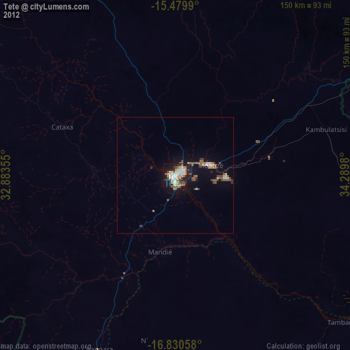
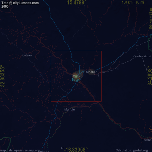
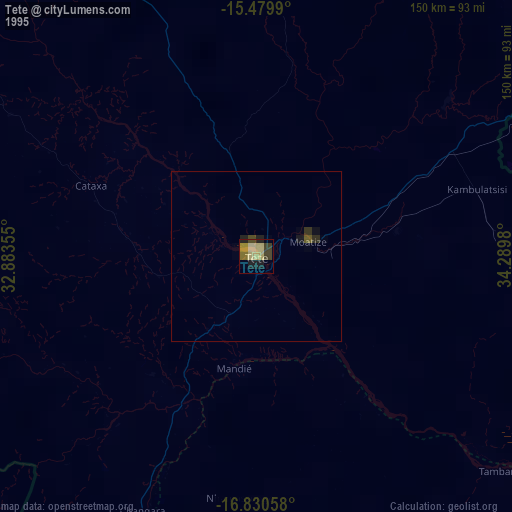
Tete night lights from space
Night Light of Tete from space (Mozambique) Src. Average luminocity for 10x10km area is 61.876% and for 50x50km: 7.2049%.
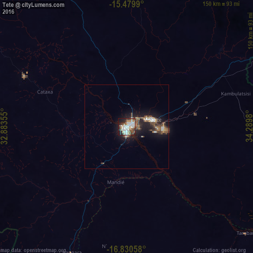
Analysis of Tete night lights 2016
Square area 10x10 km:
 17.56%
90-99
17.36%80-89
5.37%70-79
7.23%60-69
3.1%50-59
8.68%40-49
7.85%30-39
6.61%20-29
12.81%10-19
12.4%0-9
1.03%Square area 50x50 km:
1.1%90-99
1.14%80-89
0.49%70-79
0.69%60-69
0.7%50-59
1.6%40-49
1.21%30-39
0.97%20-29
2.36%10-19
6.45%0-9
83.31%Clear (daylight) street map image can be seen on geolist.org.
Map coordinates:
15° 28' 47.6" South, 32° 53' 0.8" East
16° 9' 23" South, 33° 35' 12" East
16° 49' 50.1" South, 34° 17' 23.3" East
Some cities around Tete sort by population:
• Blantyre, MW
157.5 km =97.9 mi,  74°
74°
• Nsanje, MW
197.7 km =122.8 mi,  115°
115°
• Balaka, MW
196.6 km =122.2 mi,  48°
48°
• Luchenza, MW
184.8 km =114.8 mi,  84°
84°
• Mwanza, MW
117.7 km =73.1 mi,  58°
58°
• Ntcheu, MW
186.3 km =115.8 mi,  37°
37°
• Chikwawa, MW
130.4 km =81 mi, 83°
• Thyolo, MW
166.3 km =103.3 mi,  86°
86°
1026014 (p: 129,316)
Sources (retrieved 2019-11-25):
» NASA, Earths city lights 1995
» NASA city lights 2003
» Earth at Night: Flat Maps 2012, 2016