Kulim night lights from space
Night Light of Kulim (Kedah) from space (Malaysia) Src. Average luminocity for 10x10km area is 58.0558% and for 50x50km: 32.0222%.
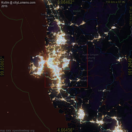
Analysis of Kulim night lights 2016
Square area 10x10 km:
 16.53%
90-99
16.74%80-89
4.96%70-79
4.96%60-69
3.51%50-59
4.96%40-49
8.68%30-39
7.85%20-29
15.7%10-19
12.81%0-9
3.31%Square area 50x50 km:
7.24%90-99
6.27%80-89
2.79%70-79
3.87%60-69
4.24%50-59
4.41%40-49
6.07%30-39
6.25%20-29
6.93%10-19
8.05%0-9
43.89%Clear (daylight) street map image can be seen on geolist.org.
Map coordinates:
6° 3' 52.6" North, 99° 51' 31.1" East
5° 21' 54" North, 100° 33' 42.4" East
4° 39' 52.4" North, 101° 15' 53.6" East
Some cities around Kulim sort by population:
• Bukit Mertajam
10.5 km =6.5 mi,  268°
268°
• Tasek Glugor
14.6 km =9.1 mi,  331°
331°
• Butterworth
22.2 km =13.8 mi,  279°
279°
• Perai
19.9 km =12.4 mi, 275°
• Nibong Tebal
24 km =14.9 mi,  202°
202°
• Permatang Kuching
22.8 km =14.2 mi,  298°
298°
• Kepala Batas
22.6 km =14 mi,  318°
318°
• Juru
14.5 km =9 mi,  245°
245°
1734393 (p: 170,889)
Sources (retrieved 2019-11-25):
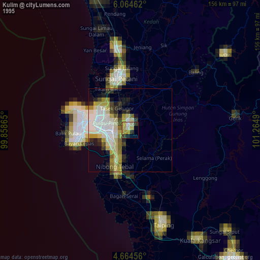
» NASA, Earths city lights 1995
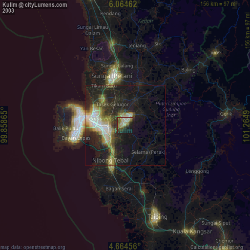
» NASA city lights 2003
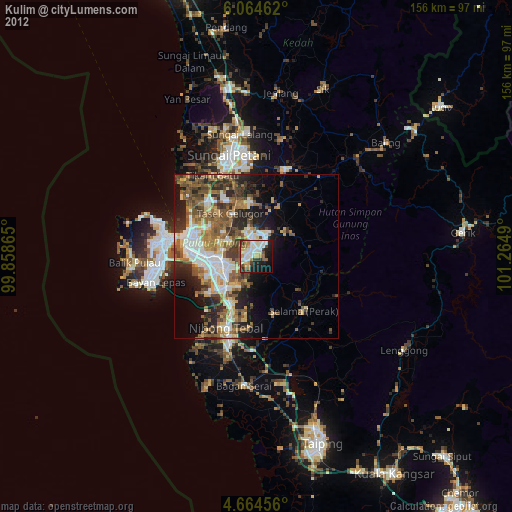
» Earth at Night: Flat Maps 2012, 2016