Shah Alam night lights from space
Night Light of Shah Alam (Selangor) from space (Malaysia) Src. Average luminocity for 10x10km area is 97.8788% and for 50x50km: 76.6218%.
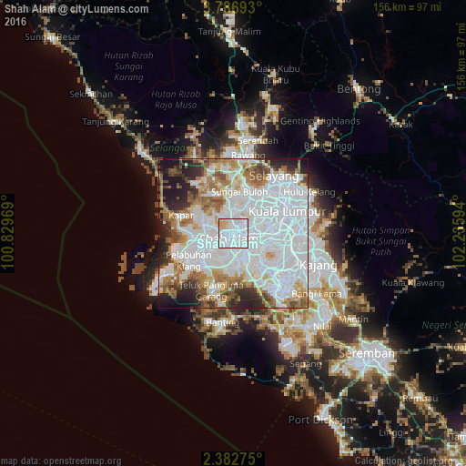
Analysis of Shah Alam night lights 2016
Square area 10x10 km:
 74.46%
90-99
16.45%80-89
6.49%70-79
2.6%60-69
0%50-59
0%40-49
0%30-39
0%20-29
0%10-19
0%0-9
0%Square area 50x50 km:
38.91%90-99
16.33%80-89
4.74%70-79
5.06%60-69
8.13%50-59
5.71%40-49
4.33%30-39
3.4%20-29
6.47%10-19
6.24%0-9
0.67%Clear (daylight) street map image can be seen on geolist.org.
Map coordinates:
3° 47' 12.9" North, 100° 49' 46.9" East
3° 5' 6.3" North, 101° 31' 58.1" East
2° 22' 57.9" North, 102° 14' 9.4" East
Some cities around Shah Alam sort by population:
• Kuala Lumpur
18.2 km =11.3 mi,  69°
69°
• Klang
11.3 km =7 mi,  241°
241°
• Kampung Baru Subang
7.2 km =4.5 mi,  0°
0°
• Subang Jaya
7 km =4.3 mi,  130°
130°
• Petaling Jaya
8.6 km =5.3 mi, 73°
• Putra Heights
11.1 km =6.9 mi,  156°
156°
• Kuang
19.5 km =12.1 mi,  6°
6°
• Pelabuhan Klang
18.2 km =11.3 mi, 238°
1732903 (p: 481,654)
Sources (retrieved 2019-11-25):
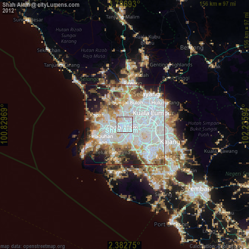
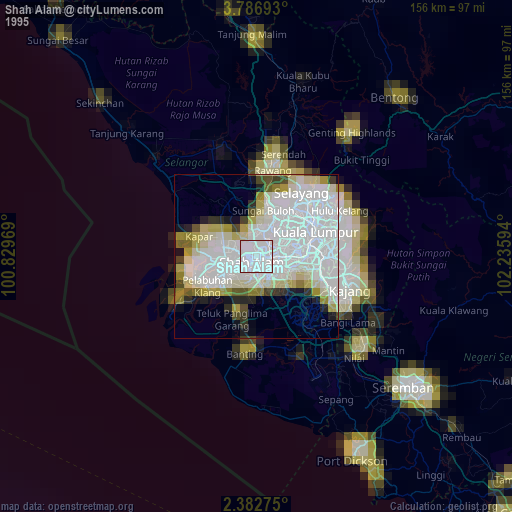
» NASA, Earths city lights 1995
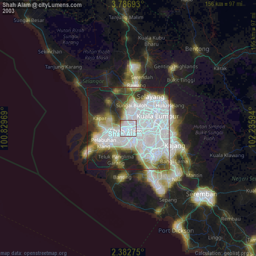
» NASA city lights 2003
» Earth at Night: Flat Maps 2012, 2016