Serendah night lights from space
Night Light of Serendah (Selangor) from space (Malaysia) Src. Average luminocity for 10x10km area is 57.9502% and for 50x50km: 37.8254%.
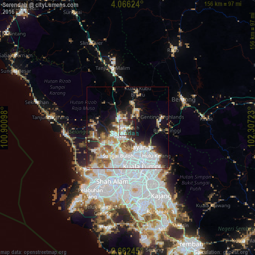
Analysis of Serendah night lights 2016
Square area 10x10 km:
 13.2%
13.2%90-99
17.1%80-89
7.36%70-79
4.55%60-69
4.33%50-59
4.55%40-49
6.06%30-39
14.07%20-29
15.15%10-19
13.64%0-9
0%Square area 50x50 km:
12.42%90-99
7.88%80-89
2.83%70-79
3.6%60-69
5.85%50-59
4.21%40-49
3.31%30-39
3.31%20-29
6.83%10-19
10.04%0-9
39.72%Clear (daylight) street map image can be seen on geolist.org.
Map coordinates:
4° 3' 58.5" North, 100° 54' 3.5" East
3° 21' 52.6" North, 101° 36' 14.8" East
2° 39' 44.8" North, 102° 18' 26" East
Some cities around Serendah sort by population:
• Kuala Lumpur
26.5 km =16.5 mi,  159°
159°
• Kampung Baru Subang
25.1 km =15.6 mi,  198°
198°
• Rawang
5.7 km =3.5 mi,  212°
212°
• Ladang Seri Kundang
12.9 km =8 mi,  227°
227°
• Batu Arang
16.2 km =10.1 mi,  250°
250°
• Kuang
12.9 km =8 mi, 205°
• Batang Berjuntai
20.9 km =13 mi,  275°
275°
• Kampung Bukit Tinggi, Bentong
24.7 km =15.3 mi,  93°
93°
1735148 (p: 28,484)
Sources (retrieved 2019-11-25):
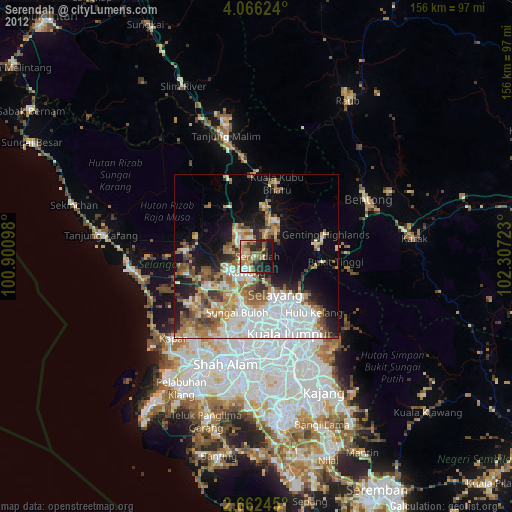
» Earth at Night: Flat Maps 2012, 2016