Villa Vicente Guerrero night lights from space
Night Light of Villa Vicente Guerrero (Tlaxcala) from space (Mexico) Src. Average luminocity for 10x10km area is 82.2879% and for 50x50km: 55.31%.
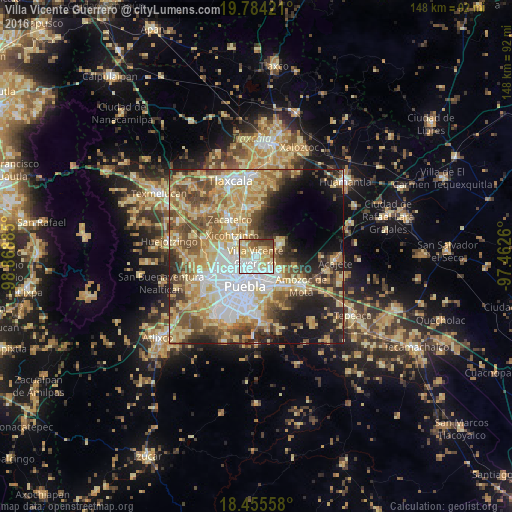
Analysis of Villa Vicente Guerrero night lights 2016
Square area 10x10 km:
 24.89%
90-99
16.23%80-89
24.03%70-79
12.55%60-69
7.14%50-59
5.63%40-49
6.49%30-39
3.03%20-29
0%10-19
0%0-9
0%Square area 50x50 km:
10.1%90-99
7.94%80-89
14.35%70-79
9.94%60-69
7.24%50-59
7.71%40-49
8.64%30-39
5.3%20-29
6.93%10-19
9.39%0-9
12.45%Clear (daylight) street map image can be seen on geolist.org.
Map coordinates:
19° 47' 3.2" North, 98° 52' 7.9" West
19° 7' 16.4" North, 98° 9' 56.6" West
18° 27' 20.1" North, 97° 27' 45.4" West
Some cities around Villa Vicente Guerrero sort by population:
• Papalotla
6.6 km =4.1 mi,  322°
322°
• San Miguel Canoa
7.4 km =4.6 mi,  62°
62°
• Santa María Xonacatepec
7.4 km =4.6 mi,  118°
118°
• Tenancingo
4.7 km =2.9 mi,  307°
307°
• Mazatecochco
6.8 km =4.2 mi,  340°
340°
• La Resurrección
4.3 km =2.7 mi, 118°
• San Isidro Buen Suceso
7.4 km =4.6 mi, 59°
• San Sebastián de Aparicio
2.1 km =1.3 mi,  165°
165°
3815453 (p: 60,001)
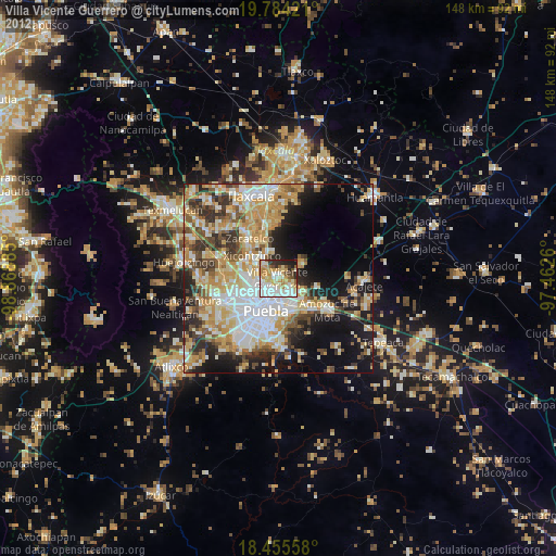
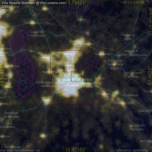
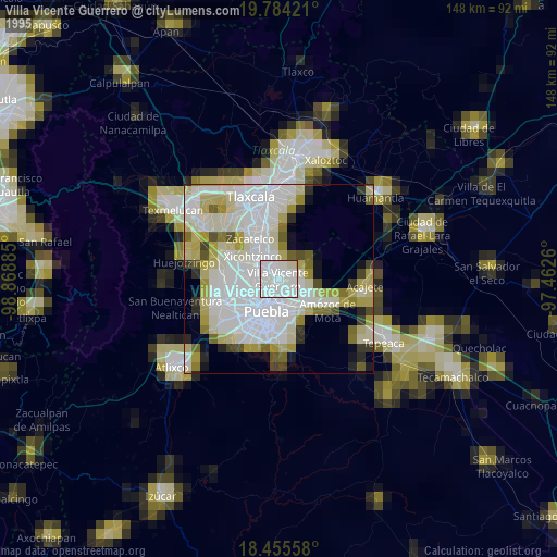
Sources (retrieved 2019-11-25):
» NASA, Earths city lights 1995
» NASA city lights 2003
» Earth at Night: Flat Maps 2012, 2016