Villa García night lights from space
Night Light of Villa García (Zacatecas) from space (Mexico) Src. Average luminocity for 10x10km area is 6.6726% and for 50x50km: 7.1548%.
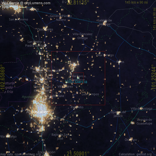
Analysis of Villa García night lights 2016
Square area 10x10 km:
 0%
0%90-99
0.4%80-89
1.98%70-79
0.79%60-69
0%50-59
0.6%40-49
1.79%30-39
0.79%20-29
0%10-19
1.98%0-9
91.67%Square area 50x50 km:
0.06%90-99
0.34%80-89
1.19%70-79
1.17%60-69
0.93%50-59
0.95%40-49
1.87%30-39
1.47%20-29
1.28%10-19
3.73%0-9
87.02%Clear (daylight) street map image can be seen on geolist.org.
Map coordinates:
22° 48' 40.9" North, 102° 39' 31.3" West
22° 9' 42.1" North, 101° 57' 20" West
21° 30' 32.4" North, 101° 15' 8.8" West
Some cities around Villa García sort by population:
• Pabellón de Arteaga
33.1 km =20.6 mi,  267°
267°
• Rincón de Romos
38.5 km =23.9 mi,  281°
281°
• Loreto
12.8 km =8 mi,  344°
344°
• San Francisco de los Romo
33.9 km =21.1 mi,  253°
253°
• Jesús Gómez Portugal (Margaritas)
39 km =24.2 mi,  242°
242°
• Jesús Gómez Portugal
39.2 km =24.4 mi, 241°
• Pinos
41.8 km =26 mi,  69°
69°
• Palo Alto
27.1 km =16.8 mi,  181°
181°
3980177 (p: 6,535)
Sources (retrieved 2019-11-25):
» Earth at Night: Flat Maps 2012, 2016