Úrsulo Galván night lights from space
Night Light of Úrsulo Galván (Veracruz) from space (Mexico) Src. Average luminocity for 10x10km area is 33.3616% and for 50x50km: 8.5477%.
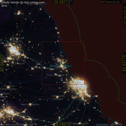
Analysis of Úrsulo Galván night lights 2016
Square area 10x10 km:
 0.83%
0.83%90-99
5.79%80-89
5.37%70-79
4.13%60-69
6.61%50-59
3.72%40-49
7.23%30-39
5.37%20-29
10.74%10-19
30.99%0-9
19.21%Square area 50x50 km:
1.31%90-99
1.36%80-89
1.06%70-79
0.91%60-69
1.19%50-59
1.15%40-49
1.45%30-39
1.51%20-29
1.76%10-19
4.62%0-9
83.68%Clear (daylight) street map image can be seen on geolist.org.
Map coordinates:
20° 4' 1.7" North, 97° 3' 50.5" West
19° 24' 19.1" North, 96° 21' 39.2" West
18° 44' 26.8" North, 95° 39' 28" West
Some cities around Úrsulo Galván sort by population:
• Valente Diaz
30.9 km =19.2 mi,  150°
150°
• José Cardel
4.2 km =2.6 mi,  192°
192°
• Las Amapolas
33 km =20.5 mi, 148°
• Fraccionamiento Geovillas los Pinos
25.2 km =15.7 mi, 145°
• Villa Zempoala
6.5 km =4 mi,  311°
311°
• Rinconada
22.2 km =13.8 mi,  255°
255°
• Paso de Ovejas
15.8 km =9.8 mi,  211°
211°
• Cabezas
4.4 km =2.7 mi, 211°
3514906 (p: 5,259)
Sources (retrieved 2019-11-25):
» Earth at Night: Flat Maps 2012, 2016