Valente Diaz night lights from space
Night Light of Valente Diaz (Veracruz) from space (Mexico) Src. Average luminocity for 10x10km area is 84.539% and for 50x50km: 18.8019%.
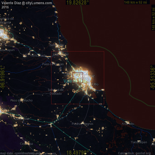
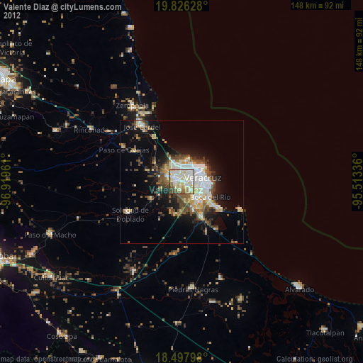
Analysis of Valente Diaz night lights 2016
Square area 10x10 km:
 22.73%
90-99
30.52%80-89
14.29%70-79
14.5%60-69
6.93%50-59
4.33%40-49
4.76%30-39
1.95%20-29
0%10-19
0%0-9
0%Square area 50x50 km:
3.12%90-99
3.38%80-89
2.29%70-79
2.76%60-69
2.34%50-59
2.25%40-49
3.24%30-39
3.13%20-29
3.89%10-19
8.27%0-9
65.32%Clear (daylight) street map image can be seen on geolist.org.
Map coordinates:
19° 49' 34.6" North, 96° 55' 10.6" West
19° 9' 48.5" North, 96° 12' 59.3" West
18° 29' 52.7" North, 95° 30' 48.1" West
Some cities around Valente Diaz sort by population:
• Veracruz
8 km =5 mi,  75°
75°
• Las Amapolas
2.3 km =1.4 mi,  123°
123°
• Fraccionamiento Geovillas los Pinos
6.1 km =3.8 mi,  350°
350°
• El Tejar
11.5 km =7.1 mi,  149°
149°
• Boca del Rio
13.5 km =8.4 mi, 118°
• Fraccionamiento Arboledas San Ramón
9.9 km =6.2 mi,  140°
140°
• Manlio Fabio Altamirano
14.5 km =9 mi,  237°
237°
• Paso del Toro
16.6 km =10.3 mi, 149°
3761202 (p: 25,700)
Sources (retrieved 2019-11-25):
» Earth at Night: Flat Maps 2012, 2016