Tlacolula de Matamoros night lights from space
Night Light of Tlacolula de Matamoros (Oaxaca) from space (Mexico) Src. Average luminocity for 10x10km area is 22.671% and for 50x50km: 8.8797%.
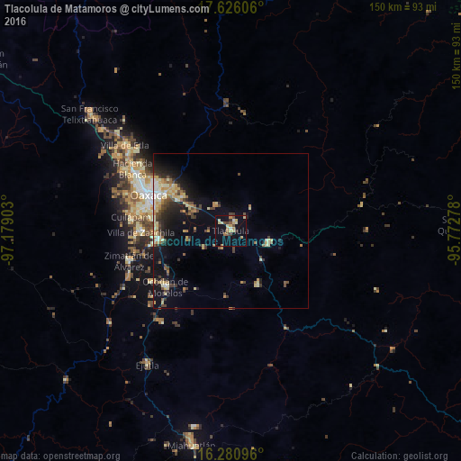
Analysis of Tlacolula de Matamoros night lights 2016
Square area 10x10 km:
 0.43%
0.43%90-99
3.46%80-89
6.49%70-79
4.98%60-69
1.52%50-59
1.52%40-49
3.25%30-39
2.38%20-29
0.65%10-19
17.53%0-9
57.79%Square area 50x50 km:
0.43%90-99
1.03%80-89
1.75%70-79
1.6%60-69
1.03%50-59
0.77%40-49
1.83%30-39
1.52%20-29
1.85%10-19
5.96%0-9
82.22%Clear (daylight) street map image can be seen on geolist.org.
Map coordinates:
17° 37' 33.8" North, 97° 10' 44.5" West
16° 57' 17" North, 96° 28' 33.2" West
16° 16' 51.5" North, 95° 46' 22" West
Some cities around Tlacolula de Matamoros sort by population:
• San Antonio de la Cal
25.3 km =15.7 mi,  289°
289°
• Vicente Guerrero
24.1 km =15 mi,  264°
264°
• El Rosario
25 km =15.5 mi, 293°
• Santa Cruz Amilpas
24.9 km =15.5 mi,  297°
297°
• Tlalixtac de Cabrera
22.3 km =13.9 mi,  305°
305°
• San Pablo Villa de Mitla
12.8 km =8 mi,  106°
106°
• Santa María del Tule
19.9 km =12.4 mi, 301°
• San Dionisio Ocotepec
18.9 km =11.7 mi,  152°
152°
3515484 (p: 13,821)
Sources (retrieved 2019-11-25):
» Earth at Night: Flat Maps 2012, 2016