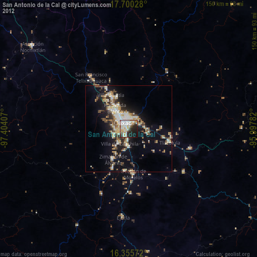
San Antonio de la Cal night lights from space
Night Light of San Antonio de la Cal (Oaxaca) from space (Mexico) Src. Average luminocity for 10x10km area is 71.7511% and for 50x50km: 18.9865%.
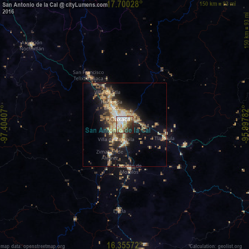
Analysis of San Antonio de la Cal night lights 2016
Square area 10x10 km:
 16.23%
90-99
22.94%80-89
13.2%70-79
10.61%60-69
4.11%50-59
4.55%40-49
10.39%30-39
4.11%20-29
11.04%10-19
2.81%0-9
0%Square area 50x50 km:
1.41%90-99
2.82%80-89
3.39%70-79
3.73%60-69
2.64%50-59
1.93%40-49
3.83%30-39
2.96%20-29
4.36%10-19
11.64%0-9
61.28%Clear (daylight) street map image can be seen on geolist.org.
Map coordinates:
17° 42' 1" North, 97° 24' 14.7" West
17° 1' 45.2" North, 96° 42' 3.4" West
16° 21' 20.6" North, 95° 59' 52.2" West
Some cities around San Antonio de la Cal sort by population:
• Oaxaca
4.7 km =2.9 mi,  329°
329°
• Santa Cruz Xoxocotlán
3.6 km =2.2 mi,  270°
270°
• Villa de Zaachila
10.1 km =6.3 mi,  210°
210°
• Cuilapan de Guerrero
10.3 km =6.4 mi,  235°
235°
• El Rosario
1.8 km =1.1 mi,  32°
32°
• Santa Cruz Amilpas
3.7 km =2.3 mi, 30°
• Tlalixtac de Cabrera
7.4 km =4.6 mi,  50°
50°
• Santa María del Tule
7.2 km =4.5 mi,  73°
73°
3526138 (p: 20,198)
Sources (retrieved 2019-11-25):
» Earth at Night: Flat Maps 2012, 2016