San Pablo Villa de Mitla night lights from space
Night Light of San Pablo Villa de Mitla (Oaxaca) from space (Mexico) Src. Average luminocity for 10x10km area is 9.4957% and for 50x50km: 3.0459%.
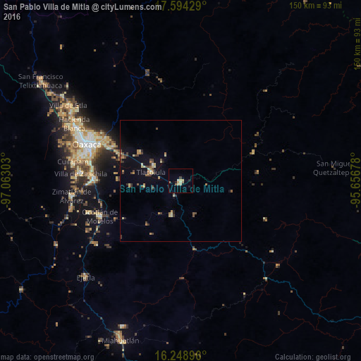
Analysis of San Pablo Villa de Mitla night lights 2016
Square area 10x10 km:
 0%
0%90-99
1.3%80-89
3.46%70-79
0.87%60-69
1.52%50-59
1.52%40-49
0.43%30-39
0.43%20-29
0.87%10-19
1.73%0-9
87.88%Square area 50x50 km:
0.02%90-99
0.28%80-89
0.59%70-79
0.55%60-69
0.38%50-59
0.3%40-49
0.73%30-39
0.56%20-29
0.19%10-19
1.41%0-9
94.99%Clear (daylight) street map image can be seen on geolist.org.
Map coordinates:
17° 35' 39.4" North, 97° 3' 46.9" West
16° 55' 22.2" North, 96° 21' 35.6" West
16° 14' 56.3" North, 95° 39' 24.4" West
Some cities around San Pablo Villa de Mitla sort by population:
• Ocotlán de Morelos
36.5 km =22.7 mi,  246°
246°
• Tlacolula de Matamoros
12.8 km =8 mi,  286°
286°
• Vicente Guerrero
36.3 km =22.6 mi,  271°
271°
• Santa Cruz Amilpas
37.5 km =23.3 mi, 293°
• Tlalixtac de Cabrera
34.7 km =21.6 mi,  298°
298°
• Santa María del Tule
32.4 km =20.1 mi, 295°
• San Dionisio Ocotepec
13.6 km =8.5 mi,  195°
195°
• San Antonino Castillo Velasco
36.9 km =22.9 mi, 248°
3518117 (p: 8,167)
Sources (retrieved 2019-11-25):
» Earth at Night: Flat Maps 2012, 2016