Texistepec night lights from space
Night Light of Texistepec (Veracruz) from space (Mexico) Src. Average luminocity for 10x10km area is 4.4221% and for 50x50km: 8.558%.
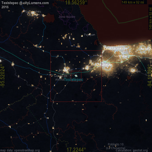
Analysis of Texistepec night lights 2016
Square area 10x10 km:
 0.22%
0.22%90-99
1.52%80-89
0%70-79
0.87%60-69
0.87%50-59
0%40-49
0%30-39
0%20-29
0%10-19
0.43%0-9
96.1%Square area 50x50 km:
0.42%90-99
1.16%80-89
1.43%70-79
1.2%60-69
0.79%50-59
1.4%40-49
2.3%30-39
1.99%20-29
1.82%10-19
5.76%0-9
81.75%Clear (daylight) street map image can be seen on geolist.org.
Map coordinates:
18° 33' 45.3" North, 95° 31' 12.9" West
17° 53' 41.1" North, 94° 49' 1.6" West
17° 13' 27.8" North, 94° 6' 50.4" West
Some cities around Texistepec sort by population:
• Acayucan
11.9 km =7.4 mi,  300°
300°
• Jáltipan de Morelos
13.4 km =8.3 mi,  54°
54°
• Oteapan
19.9 km =12.4 mi, 53°
• Sayula de Alemán
15.2 km =9.4 mi,  264°
264°
• Oluta
9.3 km =5.8 mi,  294°
294°
• Zaragoza
19.8 km =12.3 mi,  69°
69°
• Coacotla
16.5 km =10.3 mi, 73°
• Soconusco
10.2 km =6.3 mi,  318°
318°
3515710 (p: 9,655)
Sources (retrieved 2019-11-25):
» Earth at Night: Flat Maps 2012, 2016