Oluta night lights from space
Night Light of Oluta (Veracruz) from space (Mexico) Src. Average luminocity for 10x10km area is 34.2013% and for 50x50km: 5.2391%.
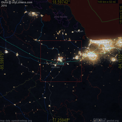
Analysis of Oluta night lights 2016
Square area 10x10 km:
 3.03%
3.03%90-99
7.79%80-89
8.01%70-79
5.41%60-69
1.95%50-59
3.25%40-49
3.68%30-39
4.76%20-29
3.68%10-19
29.44%0-9
29%Square area 50x50 km:
0.22%90-99
0.59%80-89
0.84%70-79
0.72%60-69
0.36%50-59
0.87%40-49
1.15%30-39
1.2%20-29
1.21%10-19
4.3%0-9
88.54%Clear (daylight) street map image can be seen on geolist.org.
Map coordinates:
18° 35' 50.7" North, 95° 35' 59.1" West
17° 55' 47" North, 94° 53' 47.8" West
17° 15' 34.2" North, 94° 11' 36.6" West
Some cities around Oluta sort by population:
• Acayucan
2.9 km =1.8 mi,  320°
320°
• Jáltipan de Morelos
19.7 km =12.2 mi,  78°
78°
• Oteapan
25.7 km =16 mi,  71°
71°
• Sayula de Alemán
8.5 km =5.3 mi,  231°
231°
• Texistepec
9.3 km =5.8 mi,  114°
114°
• Chinameca
25.2 km =15.7 mi, 65°
• Coacotla
24.3 km =15.1 mi,  88°
88°
• Soconusco
4.1 km =2.5 mi,  24°
24°
3522350 (p: 12,709)
Sources (retrieved 2019-11-25):
» Earth at Night: Flat Maps 2012, 2016