Tenango de Arista night lights from space
Night Light of Tenango de Arista (México) from space (Mexico) Src. Average luminocity for 10x10km area is 34.119% and for 50x50km: 38.2738%.
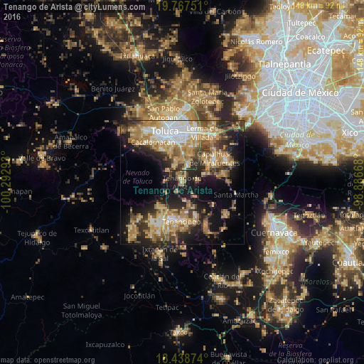
Analysis of Tenango de Arista night lights 2016
Square area 10x10 km:
 0%
0%90-99
1.08%80-89
9.74%70-79
3.9%60-69
6.06%50-59
6.06%40-49
5.19%30-39
4.33%20-29
18.83%10-19
44.59%0-9
0.22%Square area 50x50 km:
4.66%90-99
4.75%80-89
7.61%70-79
7.05%60-69
8.25%50-59
4.37%40-49
5.88%30-39
5.39%20-29
8.88%10-19
14.84%0-9
28.33%Clear (daylight) street map image can be seen on geolist.org.
Map coordinates:
19° 46' 3" North, 100° 17' 34.5" West
19° 6' 16.1" North, 99° 35' 23.3" West
18° 26' 19.5" North, 98° 53' 12" West
Some cities around Tenango de Arista sort by population:
• San Antonio la Isla
7.1 km =4.4 mi,  19°
19°
• Calimaya
7.2 km =4.5 mi,  335°
335°
• Santa María Rayón
5 km =3.1 mi,  12°
12°
• Ex-Rancho San Dimas
8.1 km =5 mi, 18°
• Santa María Jajalpa
5.7 km =3.5 mi,  81°
81°
• San Bartolomé Atlatlahuca
4.4 km =2.7 mi,  208°
208°
• San Pedro Zictepec
7.7 km =4.8 mi,  170°
170°
• Zaragoza de Guadalupe
7.5 km =4.7 mi,  310°
310°
3515993 (p: 21,765)
Sources (retrieved 2019-11-25):
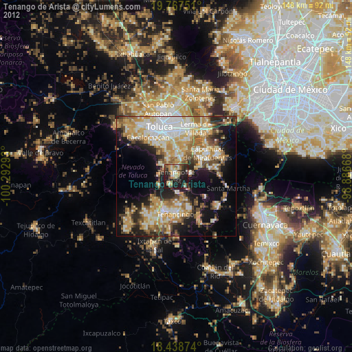
» Earth at Night: Flat Maps 2012, 2016