Tatahuicapan night lights from space
Night Light of Tatahuicapan (Veracruz) from space (Mexico) Src. Average luminocity for 10x10km area is 3.619% and for 50x50km: 5.5524%.
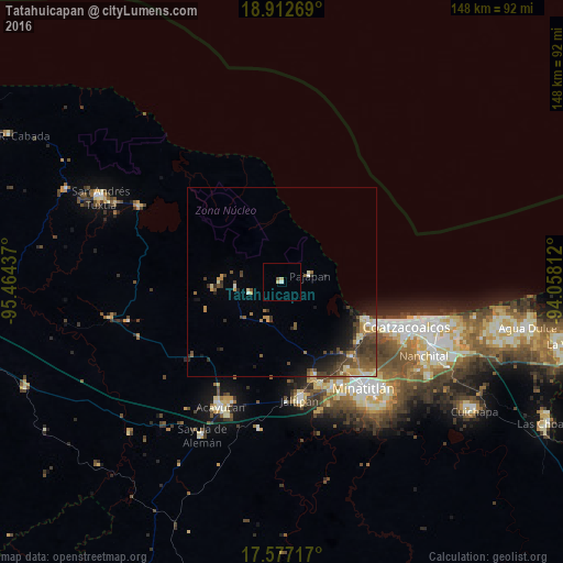
Analysis of Tatahuicapan night lights 2016
Square area 10x10 km:
 0.22%
0.22%90-99
0.65%80-89
1.73%70-79
0%60-69
0%50-59
0.87%40-49
0%30-39
0%20-29
0%10-19
0%0-9
96.54%Square area 50x50 km:
0.18%90-99
0.7%80-89
0.83%70-79
0.76%60-69
0.59%50-59
1.22%40-49
1.68%30-39
1.53%20-29
1.11%10-19
2.64%0-9
88.76%Clear (daylight) street map image can be seen on geolist.org.
Map coordinates:
18° 54' 45.7" North, 95° 27' 51.7" West
18° 14' 46.4" North, 94° 45' 40.5" West
17° 34' 37.8" North, 94° 3' 29.2" West
Some cities around Tatahuicapan sort by population:
• Cosoleacaque
30.5 km =19 mi,  154°
154°
• Fraccionamiento Ciudad Olmeca
24.5 km =15.2 mi,  115°
115°
• Oteapan
29 km =18 mi,  159°
159°
• Lomas de Barrillas
27.1 km =16.8 mi,  113°
113°
• Pajapan
7.6 km =4.7 mi,  76°
76°
• Chinameca
26.4 km =16.4 mi, 160°
• Mecayapan
8.6 km =5.3 mi,  250°
250°
• Soteapan
11.9 km =7.4 mi,  263°
263°
3516234 (p: 8,159)
Sources (retrieved 2019-11-25):
» Earth at Night: Flat Maps 2012, 2016