San Francisco del Rincón night lights from space
Night Light of San Francisco del Rincón (Guanajuato) from space (Mexico) Src. Average luminocity for 10x10km area is 65.625% and for 50x50km: 22.1171%.
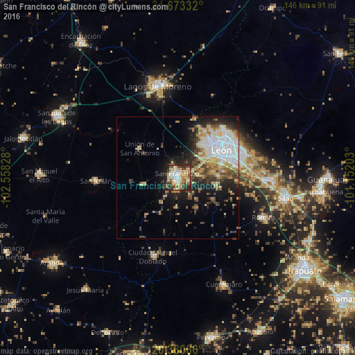
Analysis of San Francisco del Rincón night lights 2016
Square area 10x10 km:
 9.33%
9.33%90-99
14.48%80-89
16.87%70-79
10.71%60-69
9.72%50-59
4.17%40-49
11.51%30-39
7.74%20-29
13.69%10-19
1.79%0-9
0%Square area 50x50 km:
5.11%90-99
3.48%80-89
3.38%70-79
2.76%60-69
2.55%50-59
1.88%40-49
3.94%30-39
2.83%20-29
5.29%10-19
8.52%0-9
60.26%Clear (daylight) street map image can be seen on geolist.org.
Map coordinates:
21° 40' 24" North, 102° 33' 29.8" West
21° 1' 6.3" North, 101° 51' 18.5" West
20° 21' 38.4" North, 101° 9' 7.3" West
Some cities around San Francisco del Rincón sort by population:
• León de los Aldama
22.5 km =14 mi,  56°
56°
• Purísima de Bustos
2.8 km =1.7 mi,  301°
301°
• Centro Familiar la Soledad
17 km =10.6 mi,  40°
40°
• La Ermita
19.5 km =12.1 mi, 40°
• Medina
28.2 km =17.5 mi, 58°
• Unión de San Antonio
19.8 km =12.3 mi,  307°
307°
• San Diego de Alejandría
14.8 km =9.2 mi,  259°
259°
• Plan de Ayala
15.1 km =9.4 mi,  66°
66°
3986984 (p: 71,139)
Sources (retrieved 2019-11-25):
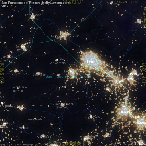
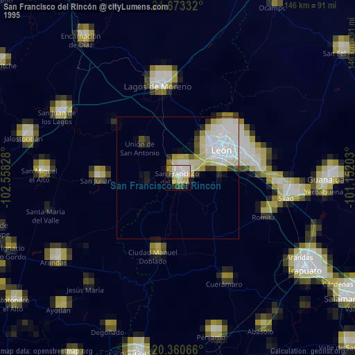
» NASA, Earths city lights 1995
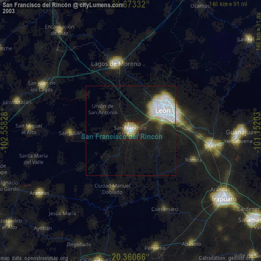
» NASA city lights 2003
» Earth at Night: Flat Maps 2012, 2016