León de los Aldama night lights from space
Night Light of León de los Aldama (Guanajuato) from space (Mexico) Src. Average luminocity for 10x10km area is 98.8849% and for 50x50km: 31.1926%.
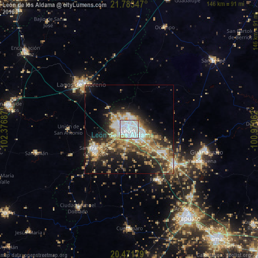
Analysis of León de los Aldama night lights 2016
Square area 10x10 km:
 75.99%
90-99
19.44%80-89
3.57%70-79
0.99%60-69
0%50-59
0%40-49
0%30-39
0%20-29
0%10-19
0%0-9
0%Square area 50x50 km:
6.22%90-99
4.53%80-89
5.12%70-79
4.77%60-69
4.13%50-59
3.3%40-49
5.64%30-39
4.37%20-29
7.83%10-19
11.54%0-9
42.56%Clear (daylight) street map image can be seen on geolist.org.
Map coordinates:
21° 47' 0.5" North, 102° 22' 36.7" West
21° 7' 44.7" North, 101° 40' 25.5" West
20° 28' 18.4" North, 100° 58' 14.2" West
Some cities around León de los Aldama sort by population:
• San Francisco del Rincón
22.5 km =14 mi,  236°
236°
• Purísima de Bustos
23.8 km =14.8 mi, 242°
• Centro Familiar la Soledad
7.9 km =4.9 mi,  274°
274°
• La Ermita
6.7 km =4.2 mi,  292°
292°
• Medina
5.8 km =3.6 mi,  66°
66°
• Duarte
16.2 km =10.1 mi,  106°
106°
• La Aldea
32.4 km =20.1 mi,  141°
141°
• Plan de Ayala
8.1 km =5 mi,  218°
218°
3998655 (p: 1,238,962)
Sources (retrieved 2019-11-25):
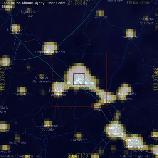
» NASA, Earths city lights 1995
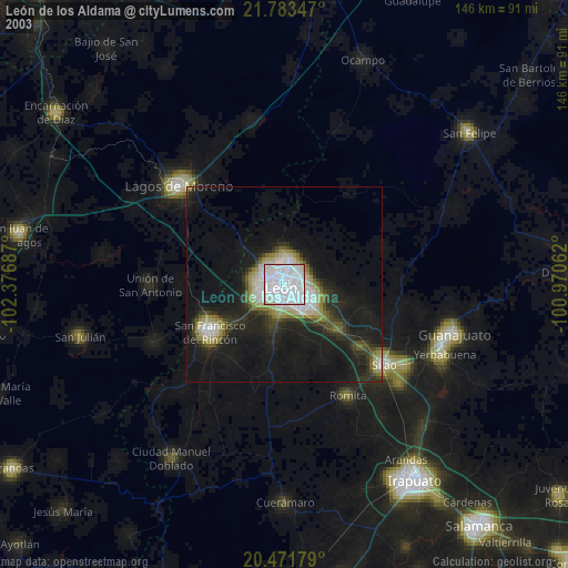
» NASA city lights 2003
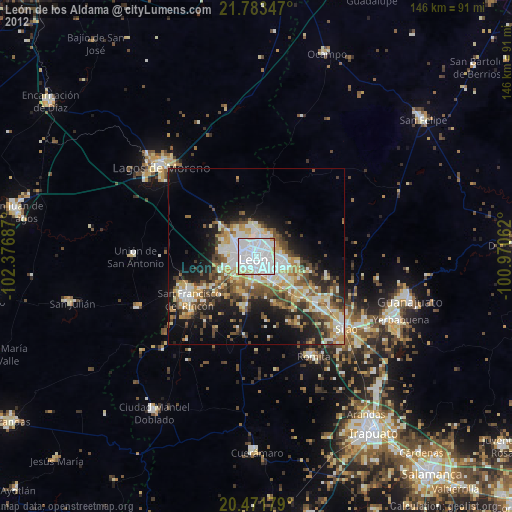
» Earth at Night: Flat Maps 2012, 2016