Villa de Zaachila night lights from space
Night Light of Villa de Zaachila (Oaxaca) from space (Mexico) Src. Average luminocity for 10x10km area is 51.7641% and for 50x50km: 17.7725%.
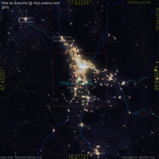
Analysis of Villa de Zaachila night lights 2016
Square area 10x10 km:
 1.52%
1.52%90-99
9.09%80-89
11.47%70-79
11.26%60-69
3.68%50-59
7.79%40-49
17.1%30-39
8.01%20-29
19.26%10-19
10.82%0-9
0%Square area 50x50 km:
1.44%90-99
2.8%80-89
3.11%70-79
3.27%60-69
2.24%50-59
1.92%40-49
3.47%30-39
2.82%20-29
4.16%10-19
10.46%0-9
64.32%Clear (daylight) street map image can be seen on geolist.org.
Map coordinates:
17° 37' 20.4" North, 97° 27' 9" West
16° 57' 3.5" North, 96° 44' 57.8" West
16° 16' 38" North, 96° 2' 46.5" West
Some cities around Villa de Zaachila sort by population:
• Oaxaca
13 km =8.1 mi,  12°
12°
• Santa Cruz Xoxocotlán
8.9 km =5.5 mi, 9°
• San Antonio de la Cal
10.1 km =6.3 mi,  30°
30°
• Vicente Guerrero
5.5 km =3.4 mi,  111°
111°
• Cuilapan de Guerrero
4.5 km =2.8 mi,  311°
311°
• El Rosario
11.9 km =7.4 mi, 30°
• Zimatlán de Álvarez
9.8 km =6.1 mi,  202°
202°
• San Agustín de las Juntas
7.9 km =4.9 mi, 30°
3514189 (p: 13,959)
Sources (retrieved 2019-11-25):
» Earth at Night: Flat Maps 2012, 2016