Purépero de Echáiz night lights from space
Night Light of Purépero de Echáiz (Michoacán) from space (Mexico) Src. Average luminocity for 10x10km area is 17.5887% and for 50x50km: 5.1223%.
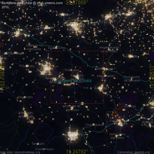
Analysis of Purépero de Echáiz night lights 2016
Square area 10x10 km:
 0%
0%90-99
1.3%80-89
4.76%70-79
3.46%60-69
1.73%50-59
0%40-49
4.76%30-39
3.68%20-29
1.95%10-19
4.33%0-9
74.03%Square area 50x50 km:
0.06%90-99
0.35%80-89
0.84%70-79
0.89%60-69
0.63%50-59
0.64%40-49
1.35%30-39
0.84%20-29
0.67%10-19
2.94%0-9
90.79%Clear (daylight) street map image can be seen on geolist.org.
Map coordinates:
20° 34' 12.3" North, 102° 42' 33.8" West
19° 54' 37.4" North, 102° 0' 22.5" West
19° 14' 52.5" North, 101° 18' 11.3" West
Some cities around Purépero de Echáiz sort by population:
• Zacapu
24.7 km =15.3 mi,  113°
113°
• Zacapú
24.9 km =15.5 mi,  115°
115°
• Paracho de Verduzco
29.6 km =18.4 mi,  188°
188°
• Tangancícuaro de Arista
21.1 km =13.1 mi,  263°
263°
• Cherán
25.6 km =15.9 mi,  167°
167°
• Chilchota
13.6 km =8.5 mi,  238°
238°
• Carapán
6.4 km =4 mi,  209°
209°
• Panindícuaro
27 km =16.8 mi,  72°
72°
3991253 (p: 13,856)
Sources (retrieved 2019-11-25):
» Earth at Night: Flat Maps 2012, 2016