Pachuca de Soto night lights from space
Night Light of Pachuca de Soto (Hidalgo) from space (Mexico) Src. Average luminocity for 10x10km area is 78.3413% and for 50x50km: 21.8969%.
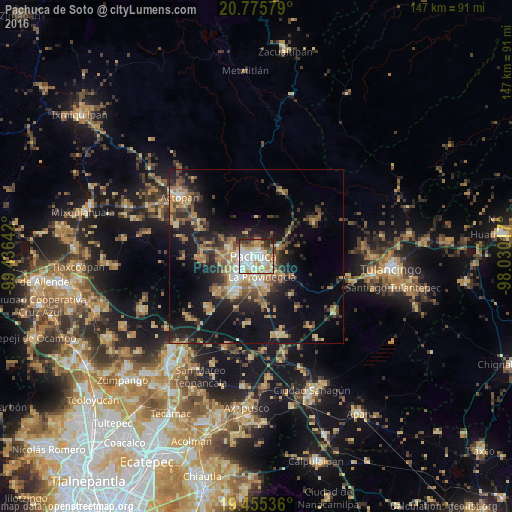
Analysis of Pachuca de Soto night lights 2016
Square area 10x10 km:
 23.21%
90-99
23.21%80-89
10.71%70-79
13.69%60-69
7.94%50-59
4.37%40-49
6.35%30-39
5.16%20-29
5.36%10-19
0%0-9
0%Square area 50x50 km:
1.83%90-99
1.99%80-89
3.47%70-79
3.45%60-69
4.35%50-59
2.41%40-49
4.34%30-39
4.12%20-29
6.36%10-19
15.78%0-9
51.9%Clear (daylight) street map image can be seen on geolist.org.
Map coordinates:
20° 46' 32.8" North, 99° 26' 11.1" West
20° 7' 1.1" North, 98° 43' 59.8" West
19° 27' 19.3" North, 98° 1' 48.6" West
Some cities around Pachuca de Soto sort by population:
• La Providencia Siglo XXI
6.1 km =3.8 mi,  164°
164°
• Mineral del Monte
6.7 km =4.2 mi,  69°
69°
• San Agustín Tlaxiaca
16 km =9.9 mi,  269°
269°
• Acayuca
15.2 km =9.4 mi,  227°
227°
• Atotonilco el Grande
20 km =12.4 mi,  19°
19°
• Campestre Villas del Álamo
3.2 km =2 mi,  122°
122°
• Unidad Minera 11 de Julio
1.7 km =1.1 mi,  141°
141°
• Los Tuzos
7.4 km =4.6 mi,  198°
198°
3522210 (p: 256,584)
Sources (retrieved 2019-11-25):
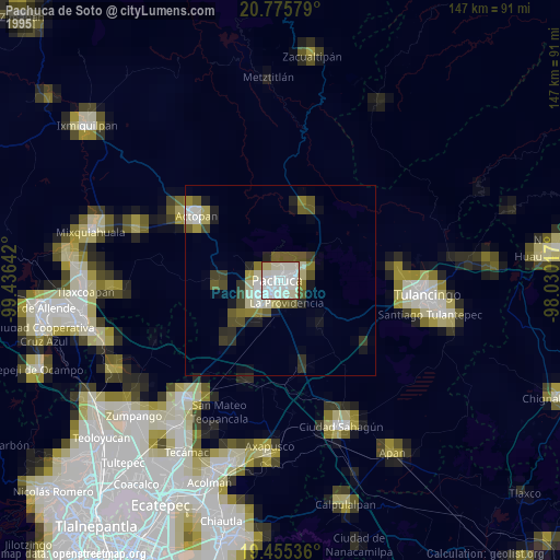
» NASA, Earths city lights 1995
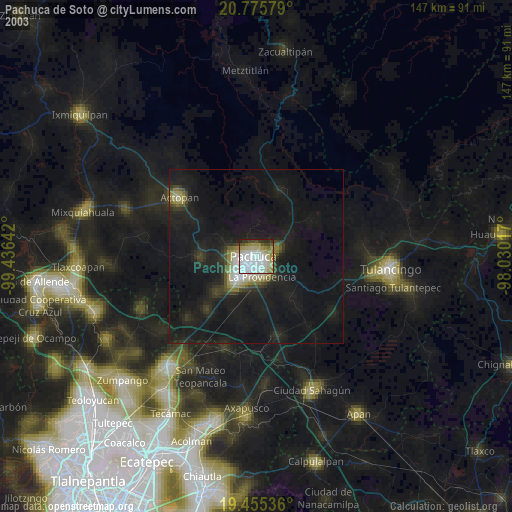
» NASA city lights 2003
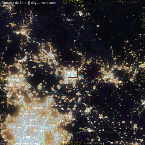
» Earth at Night: Flat Maps 2012, 2016