Nunkiní night lights from space
Night Light of Nunkiní (Campeche) from space (Mexico) Src. Average luminocity for 10x10km area is 8.7405% and for 50x50km: 4.2304%.
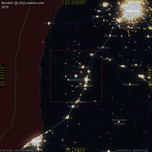
Analysis of Nunkiní night lights 2016
Square area 10x10 km:
 0.38%
0.38%90-99
1.14%80-89
1.52%70-79
2.27%60-69
0.76%50-59
0%40-49
1.14%30-39
0.95%20-29
0.19%10-19
0.57%0-9
91.1%Square area 50x50 km:
0.16%90-99
0.7%80-89
1.01%70-79
0.37%60-69
0.54%50-59
0.36%40-49
0.42%30-39
0.59%20-29
0.61%10-19
2.92%0-9
92.32%Clear (daylight) street map image can be seen on geolist.org.
Map coordinates:
21° 3' 29" North, 90° 51' 4.2" West
20° 24' 1.7" North, 90° 8' 52.9" West
19° 44' 24.1" North, 89° 26' 41.7" West
Some cities around Nunkiní sort by population:
• Calkiní
10.7 km =6.6 mi,  109°
109°
• Maxcanú
25.6 km =15.9 mi,  36°
36°
• Dzitbalché
13.2 km =8.2 mi,  133°
133°
• Hecelchakán
24.9 km =15.5 mi,  176°
176°
• Halachó
11.1 km =6.9 mi, 39°
• Pomuch
29.4 km =18.3 mi,  185°
185°
• Tenabo
40.9 km =25.4 mi, 191°
• Bécal
13.4 km =8.3 mi,  69°
69°
3522514 (p: 5,859)
Sources (retrieved 2019-11-25):
» Earth at Night: Flat Maps 2012, 2016