Las Varas night lights from space
Night Light of Las Varas (Nayarit) from space (Mexico) Src. Average luminocity for 10x10km area is 4.881% and for 50x50km: 1.0906%.
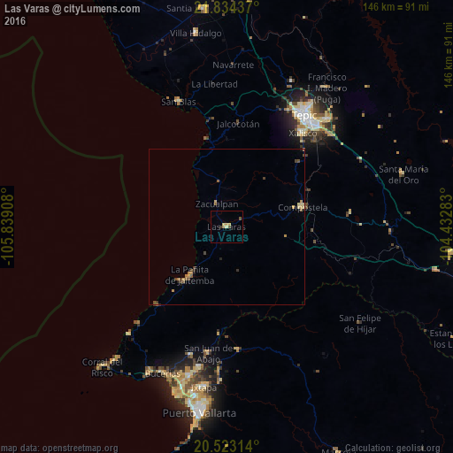
Analysis of Las Varas night lights 2016
Square area 10x10 km:
 0%
0%90-99
0%80-89
1.98%70-79
1.19%60-69
0.79%50-59
0.79%40-49
0.79%30-39
0.79%20-29
0%10-19
0%0-9
93.65%Square area 50x50 km:
0%90-99
0%80-89
0.29%70-79
0.25%60-69
0.16%50-59
0.19%40-49
0.42%30-39
0.13%20-29
0.12%10-19
0.09%0-9
98.36%Clear (daylight) street map image can be seen on geolist.org.
Map coordinates:
21° 50' 3.7" North, 105° 50' 20.7" West
21° 10' 48.8" North, 105° 8' 9.4" West
20° 31' 23.3" North, 104° 25' 58.2" West
Some cities around Las Varas sort by population:
• Tepic
44.3 km =27.5 mi,  34°
34°
• Xalisco
38.9 km =24.2 mi,  39°
39°
• San José del Valle
47.3 km =29.4 mi,  191°
191°
• Compostela
25.3 km =15.7 mi,  75°
75°
• San Juan de Abajo
41 km =25.5 mi, 188°
• San Blas
43.2 km =26.8 mi,  339°
339°
• La Peñita de Jaltomba
19.5 km =12.1 mi,  216°
216°
• Valle de Banderas
43 km =26.7 mi,  195°
195°
3999162 (p: 14,077)
Sources (retrieved 2019-11-25):
» Earth at Night: Flat Maps 2012, 2016