Jaral del Progreso night lights from space
Night Light of Jaral del Progreso (Guanajuato) from space (Mexico) Src. Average luminocity for 10x10km area is 17.6837% and for 50x50km: 29.5346%.
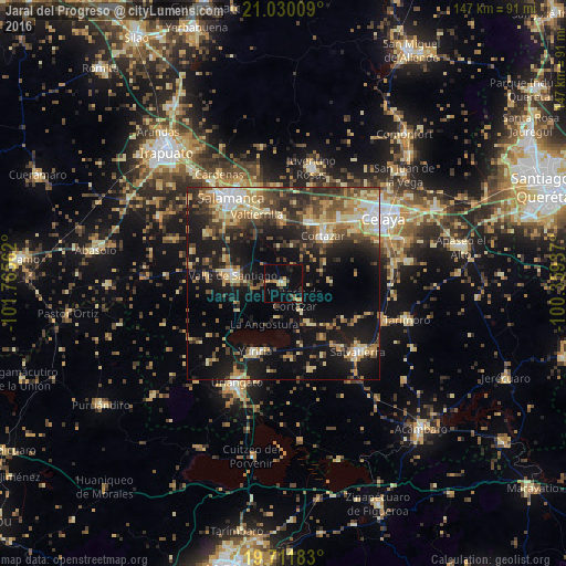
Analysis of Jaral del Progreso night lights 2016
Square area 10x10 km:
 0.19%
0.19%90-99
0.57%80-89
1.33%70-79
6.44%60-69
2.46%50-59
0.19%40-49
3.6%30-39
2.65%20-29
2.27%10-19
9.28%0-9
71.02%Square area 50x50 km:
2.04%90-99
3.28%80-89
6.03%70-79
4.6%60-69
3.78%50-59
3.73%40-49
6.55%30-39
5.5%20-29
7.45%10-19
21.14%0-9
35.91%Clear (daylight) street map image can be seen on geolist.org.
Map coordinates:
21° 1' 48.3" North, 101° 45' 56.2" West
20° 22' 20.5" North, 101° 3' 45" West
19° 42' 42.6" North, 100° 21' 33.7" West
Some cities around Jaral del Progreso sort by population:
• Valle de Santiago
13.7 km =8.5 mi,  278°
278°
• Cortazar
16.2 km =10.1 mi,  40°
40°
• Villagrán
17.2 km =10.7 mi,  23°
23°
• Yuriria
19.4 km =12.1 mi,  202°
202°
• Valtierrilla
19 km =11.8 mi,  339°
339°
• San Nicolás de los Agustinos
17.2 km =10.7 mi,  144°
144°
• Mexicanos
17.4 km =10.8 mi,  357°
357°
• Sarabia
16.7 km =10.4 mi,  0°
0°
4004092 (p: 20,457)
Sources (retrieved 2019-11-25):
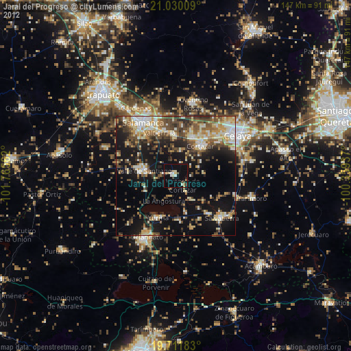
» Earth at Night: Flat Maps 2012, 2016