Heróica Zitácuaro night lights from space
Night Light of Heróica Zitácuaro (Michoacán) from space (Mexico) Src. Average luminocity for 10x10km area is 33.5909% and for 50x50km: 4.5847%.
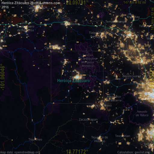
Analysis of Heróica Zitácuaro night lights 2016
Square area 10x10 km:
 0.41%
0.41%90-99
2.89%80-89
6.61%70-79
7.85%60-69
8.26%50-59
3.93%40-49
7.23%30-39
4.34%20-29
4.96%10-19
32.23%0-9
21.28%Square area 50x50 km:
0.02%90-99
0.12%80-89
0.71%70-79
0.66%60-69
0.66%50-59
0.66%40-49
1.29%30-39
1.35%20-29
0.99%10-19
2.77%0-9
90.77%Clear (daylight) street map image can be seen on geolist.org.
Map coordinates:
20° 5' 52.1" North, 101° 3' 37.7" West
19° 26' 10" North, 100° 21' 26.4" West
18° 46' 18.2" North, 99° 39' 15.2" West
Some cities around Heróica Zitácuaro sort by population:
• Ciudad Hidalgo
35.2 km =21.9 mi,  324°
324°
• Valle de Bravo
35.8 km =22.2 mi,  138°
138°
• Tuzantla
34 km =21.1 mi,  220°
220°
• Tuxpan
18.3 km =11.4 mi, 323°
• Rincón de Nicolás Romero (Cedros Tercera Manzana)
6.8 km =4.2 mi,  111°
111°
• Amanalco de Becerra
38.1 km =23.7 mi, 110°
• Colorines
32.2 km =20 mi,  153°
153°
• Jungapeo de Juárez
14.6 km =9.1 mi,  280°
280°
4004885 (p: 84,307)
Sources (retrieved 2019-11-25):
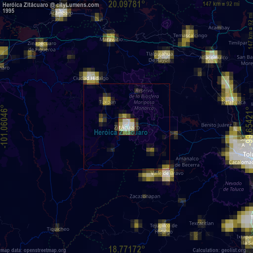
» NASA, Earths city lights 1995
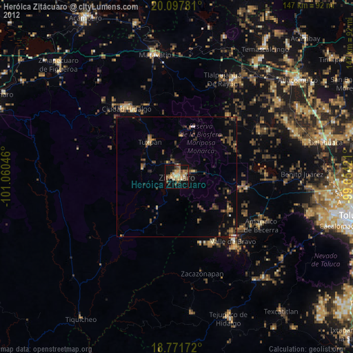
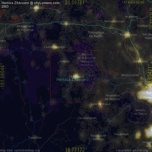
» NASA city lights 2003
» Earth at Night: Flat Maps 2012, 2016