Fraccionamiento Real Palmas night lights from space
Night Light of Fraccionamiento Real Palmas (Nuevo León) from space (Mexico) Src. Average luminocity for 10x10km area is 56.7159% and for 50x50km: 36.1795%.
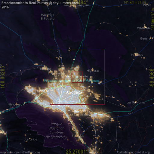
Analysis of Fraccionamiento Real Palmas night lights 2016
Square area 10x10 km:
 5.3%
5.3%90-99
3.98%80-89
4.36%70-79
10.23%60-69
16.48%50-59
25.57%40-49
17.8%30-39
4.55%20-29
6.44%10-19
5.3%0-9
0%Square area 50x50 km:
10.84%90-99
6.66%80-89
4.14%70-79
5.28%60-69
5.59%50-59
4.58%40-49
3.92%30-39
2.89%20-29
3.95%10-19
7.36%0-9
44.8%Clear (daylight) street map image can be seen on geolist.org.
Map coordinates:
26° 32' 5.8" North, 100° 51' 46.3" West
25° 54' 15" North, 100° 9' 35" West
25° 16' 12" North, 99° 27' 23.8" West
Some cities around Fraccionamiento Real Palmas sort by population:
• Ciudad Apodaca
13.9 km =8.6 mi,  191°
191°
• Ciénega de Flores
5.7 km =3.5 mi,  352°
352°
• General Zuazua
5.3 km =3.3 mi,  101°
101°
• Santa Rosa
10.8 km =6.7 mi,  215°
215°
• Prados de Santa Rosa
13.6 km =8.5 mi,  209°
209°
• Emiliano Zapata
12.1 km =7.5 mi,  273°
273°
• Real del Sol
4.4 km =2.7 mi,  330°
330°
• Villas de Alcalá
2.8 km =1.7 mi,  295°
295°
8858093 (p: 34,636)
Sources (retrieved 2019-11-25):
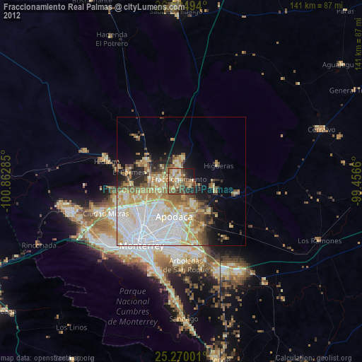
» Earth at Night: Flat Maps 2012, 2016