Colotlán night lights from space
Night Light of Colotlán (Jalisco) from space (Mexico) Src. Average luminocity for 10x10km area is 12.1171% and for 50x50km: 0.9759%.
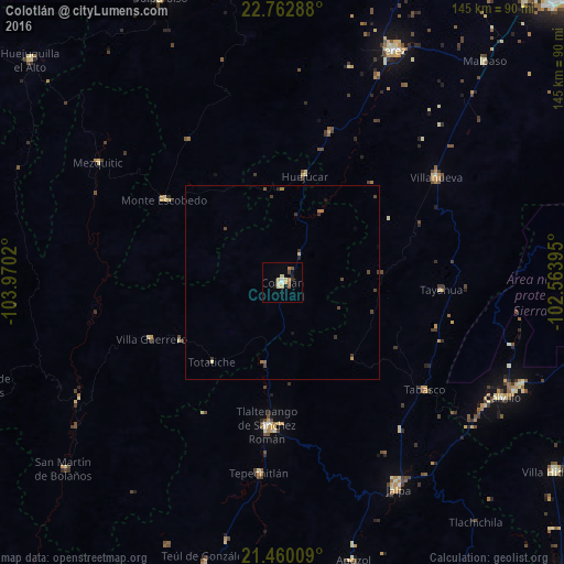
Analysis of Colotlán night lights 2016
Square area 10x10 km:
 0.4%
0.4%90-99
1.79%80-89
4.17%70-79
1.59%60-69
1.59%50-59
1.59%40-49
0.79%30-39
0.4%20-29
0.6%10-19
1.59%0-9
85.52%Square area 50x50 km:
0.02%90-99
0.09%80-89
0.21%70-79
0.09%60-69
0.2%50-59
0.13%40-49
0.28%30-39
0.24%20-29
0.1%10-19
0.16%0-9
98.49%Clear (daylight) street map image can be seen on geolist.org.
Map coordinates:
22° 45' 46.4" North, 103° 58' 12.7" West
22° 6' 46.8" North, 103° 16' 1.5" West
21° 27' 36.3" North, 102° 33' 50.2" West
Some cities around Colotlán sort by population:
• Jerez de García Salinas
66.1 km =41.1 mi,  25°
25°
• Calvillo
63.9 km =39.7 mi,  117°
117°
• Tlaltenango de Sánchez Román
37 km =23 mi,  185°
185°
• Jalpa
60.9 km =37.8 mi,  150°
150°
• Valparaíso
79.5 km =49.4 mi,  336°
336°
• Villanueva
47.9 km =29.8 mi,  55°
55°
• Tabasco
46.1 km =28.6 mi,  127°
127°
• Ojocaliente
66.4 km =41.3 mi,  113°
113°
4013136 (p: 13,256)
Sources (retrieved 2019-11-25):
» Earth at Night: Flat Maps 2012, 2016