Valparaíso night lights from space
Night Light of Valparaíso (Zacatecas) from space (Mexico) Src. Average luminocity for 10x10km area is 14.8829% and for 50x50km: 1.0907%.
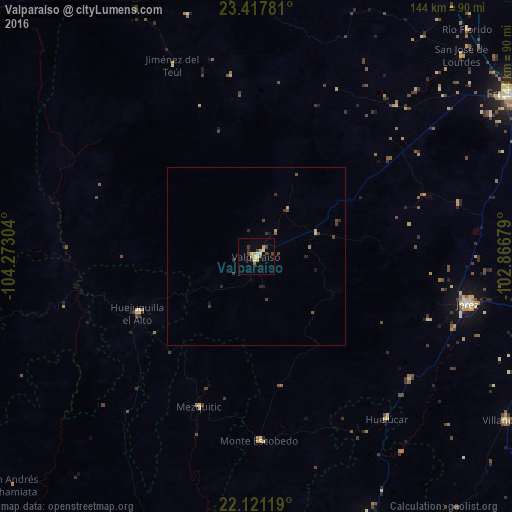
Analysis of Valparaíso night lights 2016
Square area 10x10 km:
 0.4%
0.4%90-99
2.18%80-89
2.98%70-79
3.97%60-69
0.79%50-59
1.19%40-49
3.37%30-39
2.18%20-29
0.4%10-19
0.79%0-9
81.75%Square area 50x50 km:
0.02%90-99
0.1%80-89
0.18%70-79
0.21%60-69
0.07%50-59
0.13%40-49
0.38%30-39
0.27%20-29
0.24%10-19
0.13%0-9
98.29%Clear (daylight) street map image can be seen on geolist.org.
Map coordinates:
23° 25' 4.1" North, 104° 16' 22.9" West
22° 46' 15.7" North, 103° 34' 11.7" West
22° 7' 16.3" North, 102° 52' 0.4" West
Some cities around Valparaíso sort by population:
• Fresnillo
84.8 km =52.7 mi,  57°
57°
• Jerez de García Salinas
61 km =37.9 mi,  102°
102°
• Víctor Rosales
91.1 km =56.6 mi,  77°
77°
• Sombrerete
96.3 km =59.8 mi,  355°
355°
• Colotlán
79.5 km =49.4 mi,  156°
156°
• Villanueva
84.4 km =52.4 mi,  123°
123°
• San Jose de Lourdes
80.3 km =49.9 mi,  45°
45°
• Sain Alto
95.9 km =59.6 mi,  20°
20°
3980586 (p: 12,919)
Sources (retrieved 2019-11-25):
» Earth at Night: Flat Maps 2012, 2016