Colonia Venustiano Carranza night lights from space
Night Light of Colonia Venustiano Carranza (Baja California) from space (Mexico) Src. Average luminocity for 10x10km area is 7.1465% and for 50x50km: 3.1184%.
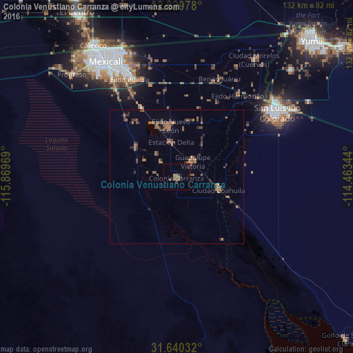
Analysis of Colonia Venustiano Carranza night lights 2016
Square area 10x10 km:
 0%
0%90-99
0%80-89
0%70-79
0%60-69
4.58%50-59
1.83%40-49
0.92%30-39
1.47%20-29
0.73%10-19
1.47%0-9
89.01%Square area 50x50 km:
0%90-99
0%80-89
0%70-79
0.09%60-69
1.57%50-59
1%40-49
0.7%30-39
0.68%20-29
0.64%10-19
0.5%0-9
94.82%Clear (daylight) street map image can be seen on geolist.org.
Map coordinates:
32° 49' 47.2" North, 115° 52' 10.9" West
32° 14' 13.2" North, 115° 9' 59.6" West
31° 38' 25.2" North, 114° 27' 48.4" West
Some cities around Colonia Venustiano Carranza sort by population:
• Guadalupe Victoria
8.2 km =5.1 mi,  44°
44°
• Puebla
40.6 km =25.2 mi,  334°
334°
• Doctor Alberto Oviedo Mota
1.1 km =0.7 mi,  186°
186°
• Estación Coahuila
16.5 km =10.3 mi,  107°
107°
• Ciudad Coahuila (Kilómetro Cincuenta y Siete)
16.1 km =10 mi, 106°
• Tecolots
40.5 km =25.2 mi,  25°
25°
• Delta
13.4 km =8.3 mi,  348°
348°
• Hermosillo
38.1 km =23.7 mi, 36°
3979503 (p: 6,098)
Sources (retrieved 2019-11-25):
» Earth at Night: Flat Maps 2012, 2016